You are here: Home > Network List > US - United States National Seismic Network Stations List
> Station BOZ Bozeman, Montana, USA > Earthquake Result Viewer
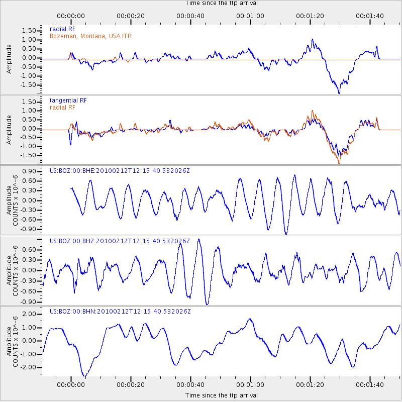
BOZ Bozeman, Montana, USA - Earthquake Result Viewer
*The percent match for this event was below the threshold and hence no stack was calculated.
| Earthquake location: |
Mendoza Province, Argentina |
| Earthquake latitude/longitude: |
-33.6/-68.8 |
| Earthquake time(UTC): |
2010/02/12 (043) 12:03:38 GMT |
| Earthquake Depth: |
148 km |
| Earthquake Magnitude: |
5.6 MB, 5.8 MW, 5.8 MW |
| Earthquake Catalog/Contributor: |
WHDF/NEIC |
|
| Network: |
US United States National Seismic Network |
| Station: |
BOZ Bozeman, Montana, USA |
| Lat/Lon: |
45.65 N/111.63 W |
| Elevation: |
1589 m |
|
| Distance: |
87.9 deg |
| Az: |
331.491 deg |
| Baz: |
145.407 deg |
| Ray Param: |
$rayparam |
*The percent match for this event was below the threshold and hence was not used in the summary stack. |
|
| Radial Match: |
36.76352 % |
| Radial Bump: |
400 |
| Transverse Match: |
37.80881 % |
| Transverse Bump: |
400 |
| SOD ConfigId: |
306082 |
| Insert Time: |
2010-05-06 07:08:06.661 +0000 |
| GWidth: |
2.5 |
| Max Bumps: |
400 |
| Tol: |
0.001 |
|
Signal To Noise
| Channel | StoN | STA | LTA |
| US:BOZ:00:BHZ:20100212T12:15:40.532026Z | 0.7830859 | 2.2444627E-7 | 2.8661768E-7 |
| US:BOZ:00:BHN:20100212T12:15:40.532026Z | 1.5774966 | 1.725407E-6 | 1.0937626E-6 |
| US:BOZ:00:BHE:20100212T12:15:40.532026Z | 0.65934163 | 2.0880627E-7 | 3.1668904E-7 |
| Arrivals |
| Ps | |
| PpPs | |
| PsPs/PpSs | |


