You are here: Home > Network List > US - United States National Seismic Network Stations List
> Station DGMT Dagmar, Montana, USA > Earthquake Result Viewer
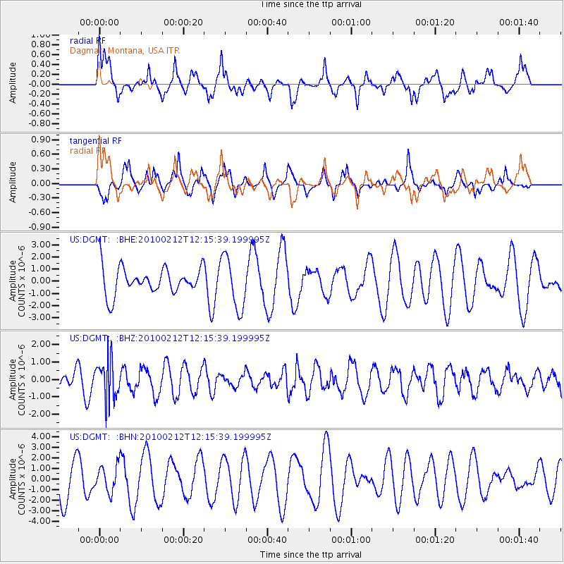
DGMT Dagmar, Montana, USA - Earthquake Result Viewer
*The percent match for this event was below the threshold and hence no stack was calculated.
| Earthquake location: |
Mendoza Province, Argentina |
| Earthquake latitude/longitude: |
-33.6/-68.8 |
| Earthquake time(UTC): |
2010/02/12 (043) 12:03:38 GMT |
| Earthquake Depth: |
148 km |
| Earthquake Magnitude: |
5.6 MB, 5.8 MW, 5.8 MW |
| Earthquake Catalog/Contributor: |
WHDF/NEIC |
|
| Network: |
US United States National Seismic Network |
| Station: |
DGMT Dagmar, Montana, USA |
| Lat/Lon: |
48.47 N/104.20 W |
| Elevation: |
0.0 m |
|
| Distance: |
87.6 deg |
| Az: |
337.3 deg |
| Baz: |
151.063 deg |
| Ray Param: |
$rayparam |
*The percent match for this event was below the threshold and hence was not used in the summary stack. |
|
| Radial Match: |
55.09916 % |
| Radial Bump: |
400 |
| Transverse Match: |
59.112404 % |
| Transverse Bump: |
379 |
| SOD ConfigId: |
306082 |
| Insert Time: |
2010-05-06 07:08:27.219 +0000 |
| GWidth: |
2.5 |
| Max Bumps: |
400 |
| Tol: |
0.001 |
|
Signal To Noise
| Channel | StoN | STA | LTA |
| US:DGMT: :BHZ:20100212T12:15:39.199995Z | 2.139531 | 1.1644526E-6 | 5.44256E-7 |
| US:DGMT: :BHN:20100212T12:15:39.199995Z | 0.73750824 | 1.2647621E-6 | 1.7149124E-6 |
| US:DGMT: :BHE:20100212T12:15:39.199995Z | 2.0156376 | 2.1690607E-6 | 1.0761165E-6 |
| Arrivals |
| Ps | |
| PpPs | |
| PsPs/PpSs | |


