You are here: Home > Network List > CI - Caltech Regional Seismic Network Stations List
> Station RCT Rector, Visalia, CA, USA > Earthquake Result Viewer
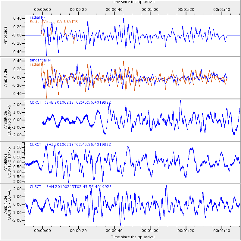
RCT Rector, Visalia, CA, USA - Earthquake Result Viewer
*The percent match for this event was below the threshold and hence no stack was calculated.
| Earthquake location: |
Tonga Islands |
| Earthquake latitude/longitude: |
-21.9/-174.8 |
| Earthquake time(UTC): |
2010/02/13 (044) 02:34:28 GMT |
| Earthquake Depth: |
11 km |
| Earthquake Magnitude: |
6.0 MB, 6.2 MS, 6.1 MW, 6.0 MW |
| Earthquake Catalog/Contributor: |
WHDF/NEIC |
|
| Network: |
CI Caltech Regional Seismic Network |
| Station: |
RCT Rector, Visalia, CA, USA |
| Lat/Lon: |
36.31 N/119.24 W |
| Elevation: |
107 m |
|
| Distance: |
78.1 deg |
| Az: |
42.881 deg |
| Baz: |
231.476 deg |
| Ray Param: |
$rayparam |
*The percent match for this event was below the threshold and hence was not used in the summary stack. |
|
| Radial Match: |
67.03756 % |
| Radial Bump: |
400 |
| Transverse Match: |
70.177284 % |
| Transverse Bump: |
400 |
| SOD ConfigId: |
306082 |
| Insert Time: |
2010-05-06 07:16:40.129 +0000 |
| GWidth: |
2.5 |
| Max Bumps: |
400 |
| Tol: |
0.001 |
|
Signal To Noise
| Channel | StoN | STA | LTA |
| CI:RCT: :BHZ:20100213T02:45:56.401992Z | 3.5441334 | 9.067642E-7 | 2.5584936E-7 |
| CI:RCT: :BHN:20100213T02:45:56.401992Z | 1.3049734 | 5.3228285E-7 | 4.078879E-7 |
| CI:RCT: :BHE:20100213T02:45:56.401992Z | 2.6006756 | 9.928461E-7 | 3.817647E-7 |
| Arrivals |
| Ps | |
| PpPs | |
| PsPs/PpSs | |


