You are here: Home > Network List > CI - Caltech Regional Seismic Network Stations List
> Station MUR Murrieta > Earthquake Result Viewer
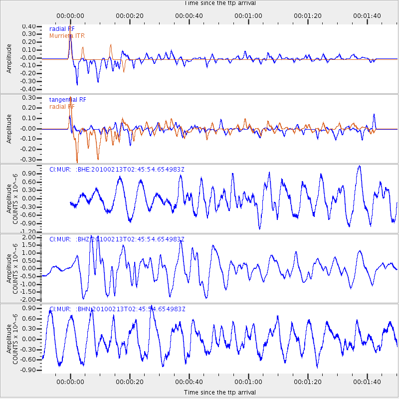
MUR Murrieta - Earthquake Result Viewer
*The percent match for this event was below the threshold and hence no stack was calculated.
| Earthquake location: |
Tonga Islands |
| Earthquake latitude/longitude: |
-21.9/-174.8 |
| Earthquake time(UTC): |
2010/02/13 (044) 02:34:28 GMT |
| Earthquake Depth: |
11 km |
| Earthquake Magnitude: |
6.0 MB, 6.2 MS, 6.1 MW, 6.0 MW |
| Earthquake Catalog/Contributor: |
WHDF/NEIC |
|
| Network: |
CI Caltech Regional Seismic Network |
| Station: |
MUR Murrieta |
| Lat/Lon: |
33.60 N/117.20 W |
| Elevation: |
562 m |
|
| Distance: |
77.8 deg |
| Az: |
46.117 deg |
| Baz: |
233.32 deg |
| Ray Param: |
$rayparam |
*The percent match for this event was below the threshold and hence was not used in the summary stack. |
|
| Radial Match: |
77.68016 % |
| Radial Bump: |
330 |
| Transverse Match: |
59.046375 % |
| Transverse Bump: |
359 |
| SOD ConfigId: |
306082 |
| Insert Time: |
2010-05-06 07:17:36.612 +0000 |
| GWidth: |
2.5 |
| Max Bumps: |
400 |
| Tol: |
0.001 |
|
Signal To Noise
| Channel | StoN | STA | LTA |
| CI:MUR: :BHZ:20100213T02:45:54.654983Z | 1.8563111 | 8.5161554E-7 | 4.587677E-7 |
| CI:MUR: :BHN:20100213T02:45:54.654983Z | 1.6802355 | 5.3634034E-7 | 3.1920547E-7 |
| CI:MUR: :BHE:20100213T02:45:54.654983Z | 0.5385829 | 2.0646739E-7 | 3.8335298E-7 |
| Arrivals |
| Ps | |
| PpPs | |
| PsPs/PpSs | |


