You are here: Home > Network List > TA - USArray Transportable Network (new EarthScope stations) Stations List
> Station 531A Rocksprings, TX, USA > Earthquake Result Viewer
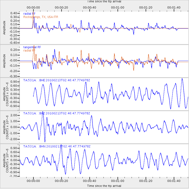
531A Rocksprings, TX, USA - Earthquake Result Viewer
*The percent match for this event was below the threshold and hence no stack was calculated.
| Earthquake location: |
Tonga Islands |
| Earthquake latitude/longitude: |
-21.9/-174.8 |
| Earthquake time(UTC): |
2010/02/13 (044) 02:34:28 GMT |
| Earthquake Depth: |
11 km |
| Earthquake Magnitude: |
6.0 MB, 6.2 MS, 6.1 MW, 6.0 MW |
| Earthquake Catalog/Contributor: |
WHDF/NEIC |
|
| Network: |
TA USArray Transportable Network (new EarthScope stations) |
| Station: |
531A Rocksprings, TX, USA |
| Lat/Lon: |
30.16 N/100.55 W |
| Elevation: |
661 m |
|
| Distance: |
88.1 deg |
| Az: |
56.499 deg |
| Baz: |
243.404 deg |
| Ray Param: |
$rayparam |
*The percent match for this event was below the threshold and hence was not used in the summary stack. |
|
| Radial Match: |
73.33978 % |
| Radial Bump: |
305 |
| Transverse Match: |
67.403404 % |
| Transverse Bump: |
400 |
| SOD ConfigId: |
306082 |
| Insert Time: |
2010-05-06 07:24:53.566 +0000 |
| GWidth: |
2.5 |
| Max Bumps: |
400 |
| Tol: |
0.001 |
|
Signal To Noise
| Channel | StoN | STA | LTA |
| TA:531A: :BHZ:20100213T02:46:47.774978Z | 2.9211178 | 9.266246E-7 | 3.1721575E-7 |
| TA:531A: :BHN:20100213T02:46:47.774978Z | 0.91057014 | 2.3441342E-7 | 2.5743586E-7 |
| TA:531A: :BHE:20100213T02:46:47.774978Z | 0.51143193 | 2.5026642E-7 | 4.8934453E-7 |
| Arrivals |
| Ps | |
| PpPs | |
| PsPs/PpSs | |


