You are here: Home > Network List > TA - USArray Transportable Network (new EarthScope stations) Stations List
> Station 534A Blanco, TX, USA > Earthquake Result Viewer
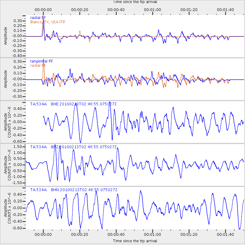
534A Blanco, TX, USA - Earthquake Result Viewer
*The percent match for this event was below the threshold and hence no stack was calculated.
| Earthquake location: |
Tonga Islands |
| Earthquake latitude/longitude: |
-21.9/-174.8 |
| Earthquake time(UTC): |
2010/02/13 (044) 02:34:28 GMT |
| Earthquake Depth: |
11 km |
| Earthquake Magnitude: |
6.0 MB, 6.2 MS, 6.1 MW, 6.0 MW |
| Earthquake Catalog/Contributor: |
WHDF/NEIC |
|
| Network: |
TA USArray Transportable Network (new EarthScope stations) |
| Station: |
534A Blanco, TX, USA |
| Lat/Lon: |
30.03 N/98.48 W |
| Elevation: |
461 m |
|
| Distance: |
89.6 deg |
| Az: |
57.409 deg |
| Baz: |
244.455 deg |
| Ray Param: |
$rayparam |
*The percent match for this event was below the threshold and hence was not used in the summary stack. |
|
| Radial Match: |
56.96771 % |
| Radial Bump: |
400 |
| Transverse Match: |
53.07189 % |
| Transverse Bump: |
290 |
| SOD ConfigId: |
306082 |
| Insert Time: |
2010-05-06 07:28:19.747 +0000 |
| GWidth: |
2.5 |
| Max Bumps: |
400 |
| Tol: |
0.001 |
|
Signal To Noise
| Channel | StoN | STA | LTA |
| TA:534A: :BHZ:20100213T02:46:55.075027Z | 2.7183068 | 6.278517E-7 | 2.3097161E-7 |
| TA:534A: :BHN:20100213T02:46:55.075027Z | 0.6947299 | 1.2624974E-7 | 1.8172491E-7 |
| TA:534A: :BHE:20100213T02:46:55.075027Z | 0.95412403 | 2.4375268E-7 | 2.5547274E-7 |
| Arrivals |
| Ps | |
| PpPs | |
| PsPs/PpSs | |


