You are here: Home > Network List > UW - Pacific Northwest Regional Seismic Network Stations List
> Station MRBL Marblemount, WA, USA > Earthquake Result Viewer
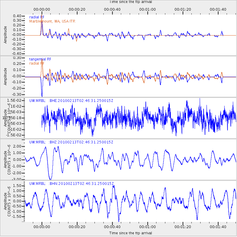
MRBL Marblemount, WA, USA - Earthquake Result Viewer
*The percent match for this event was below the threshold and hence no stack was calculated.
| Earthquake location: |
Tonga Islands |
| Earthquake latitude/longitude: |
-21.9/-174.8 |
| Earthquake time(UTC): |
2010/02/13 (044) 02:34:28 GMT |
| Earthquake Depth: |
11 km |
| Earthquake Magnitude: |
6.0 MB, 6.2 MS, 6.1 MW, 6.0 MW |
| Earthquake Catalog/Contributor: |
WHDF/NEIC |
|
| Network: |
UW Pacific Northwest Regional Seismic Network |
| Station: |
MRBL Marblemount, WA, USA |
| Lat/Lon: |
48.52 N/121.48 W |
| Elevation: |
75 m |
|
| Distance: |
84.7 deg |
| Az: |
32.36 deg |
| Baz: |
228.384 deg |
| Ray Param: |
$rayparam |
*The percent match for this event was below the threshold and hence was not used in the summary stack. |
|
| Radial Match: |
48.801403 % |
| Radial Bump: |
400 |
| Transverse Match: |
48.934483 % |
| Transverse Bump: |
390 |
| SOD ConfigId: |
306082 |
| Insert Time: |
2010-05-06 07:31:24.655 +0000 |
| GWidth: |
2.5 |
| Max Bumps: |
400 |
| Tol: |
0.001 |
|
Signal To Noise
| Channel | StoN | STA | LTA |
| UW:MRBL: :BHZ:20100213T02:46:31.250015Z | 3.9364474 | 1.5647859E-6 | 3.9751222E-7 |
| UW:MRBL: :BHN:20100213T02:46:31.250015Z | 2.0810876 | 7.091441E-7 | 3.4075646E-7 |
| UW:MRBL: :BHE:20100213T02:46:31.250015Z | 1.5707802 | 7.1738557E-9 | 4.5670654E-9 |
| Arrivals |
| Ps | |
| PpPs | |
| PsPs/PpSs | |


