You are here: Home > Network List > US - United States National Seismic Network Stations List
> Station AMTX Amarillo, Texas, USA > Earthquake Result Viewer
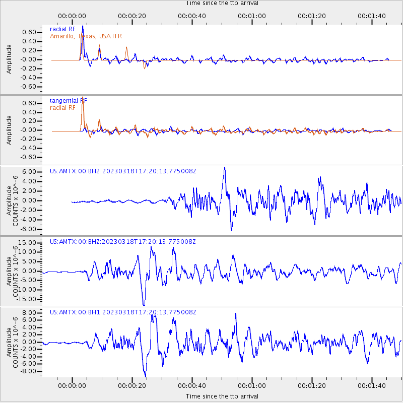
AMTX Amarillo, Texas, USA - Earthquake Result Viewer
*The percent match for this event was below the threshold and hence no stack was calculated.
| Earthquake location: |
Near Coast Of Ecuador |
| Earthquake latitude/longitude: |
-2.9/-79.8 |
| Earthquake time(UTC): |
2023/03/18 (077) 17:12:53 GMT |
| Earthquake Depth: |
66 km |
| Earthquake Magnitude: |
6.7 Mww |
| Earthquake Catalog/Contributor: |
NEIC PDE/us |
|
| Network: |
US United States National Seismic Network |
| Station: |
AMTX Amarillo, Texas, USA |
| Lat/Lon: |
34.53 N/101.41 W |
| Elevation: |
1010 m |
|
| Distance: |
42.4 deg |
| Az: |
333.185 deg |
| Baz: |
146.925 deg |
| Ray Param: |
$rayparam |
*The percent match for this event was below the threshold and hence was not used in the summary stack. |
|
| Radial Match: |
95.746796 % |
| Radial Bump: |
357 |
| Transverse Match: |
83.57107 % |
| Transverse Bump: |
400 |
| SOD ConfigId: |
30536071 |
| Insert Time: |
2023-04-01 17:47:51.431 +0000 |
| GWidth: |
2.5 |
| Max Bumps: |
400 |
| Tol: |
0.001 |
|
Signal To Noise
| Channel | StoN | STA | LTA |
| US:AMTX:00:BHZ:20230318T17:20:13.775008Z | 0.9141825 | 2.4682373E-7 | 2.6999393E-7 |
| US:AMTX:00:BH1:20230318T17:20:13.775008Z | 0.52880657 | 1.66956E-7 | 3.1572225E-7 |
| US:AMTX:00:BH2:20230318T17:20:13.775008Z | 1.5172737 | 2.2125566E-7 | 1.4582449E-7 |
| Arrivals |
| Ps | |
| PpPs | |
| PsPs/PpSs | |


