You are here: Home > Network List > WY - Yellowstone Wyoming Seismic Network Stations List
> Station YUF Upper Falls, WY, USA > Earthquake Result Viewer
YUF Upper Falls, WY, USA - Earthquake Result Viewer
*The percent match for this event was below the threshold and hence no stack was calculated.
| Earthquake location: |
Near Coast Of Ecuador |
| Earthquake latitude/longitude: |
-2.9/-79.8 |
| Earthquake time(UTC): |
2023/03/18 (077) 17:12:53 GMT |
| Earthquake Depth: |
66 km |
| Earthquake Magnitude: |
6.7 Mww |
| Earthquake Catalog/Contributor: |
NEIC PDE/us |
|
| Network: |
WY Yellowstone Wyoming Seismic Network |
| Station: |
YUF Upper Falls, WY, USA |
| Lat/Lon: |
44.71 N/110.51 W |
| Elevation: |
2394 m |
|
| Distance: |
54.7 deg |
| Az: |
333.507 deg |
| Baz: |
141.327 deg |
| Ray Param: |
$rayparam |
*The percent match for this event was below the threshold and hence was not used in the summary stack. |
|
| Radial Match: |
78.832184 % |
| Radial Bump: |
400 |
| Transverse Match: |
66.67615 % |
| Transverse Bump: |
400 |
| SOD ConfigId: |
30536071 |
| Insert Time: |
2023-04-01 17:54:32.708 +0000 |
| GWidth: |
2.5 |
| Max Bumps: |
400 |
| Tol: |
0.001 |
|
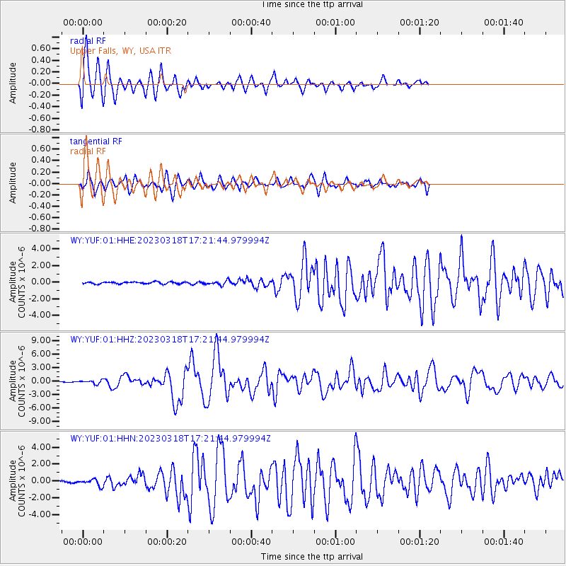
Signal To Noise
| Channel | StoN | STA | LTA |
| WY:YUF:01:HHZ:20230318T17:21:44.979994Z | 2.8558645 | 3.8528566E-7 | 1.3491034E-7 |
| WY:YUF:01:HHN:20230318T17:21:44.979994Z | 2.5930357 | 3.9165917E-7 | 1.5104273E-7 |
| WY:YUF:01:HHE:20230318T17:21:44.979994Z | 2.2949266 | 2.6038205E-7 | 1.1345987E-7 |
| Arrivals |
| Ps | |
| PpPs | |
| PsPs/PpSs | |


