You are here: Home > Network List > BK - Berkeley Digital Seismograph Network Stations List
> Station HUMO Hull Mountain, OR > Earthquake Result Viewer
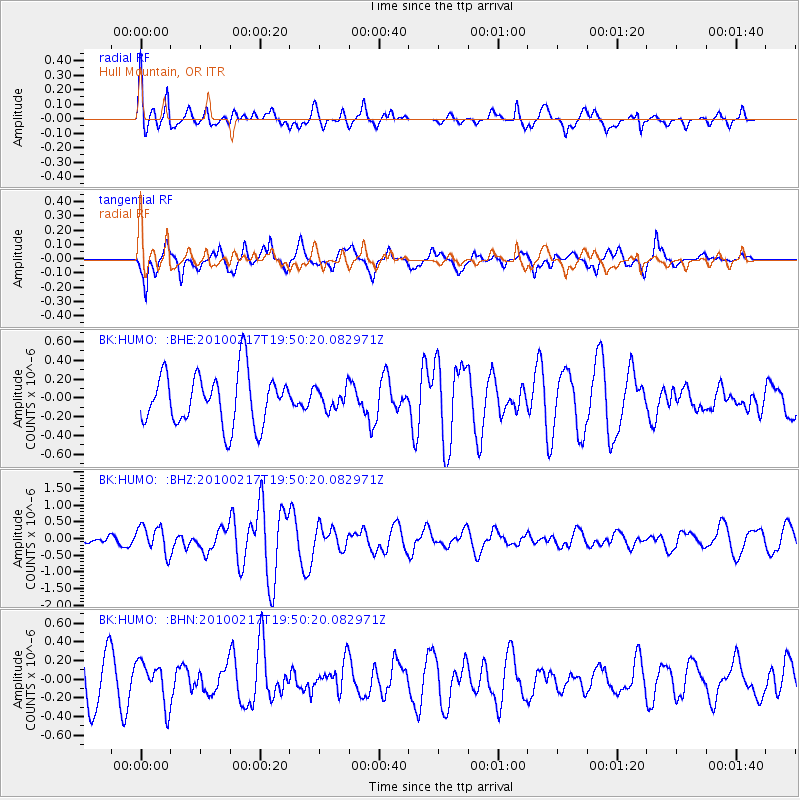
HUMO Hull Mountain, OR - Earthquake Result Viewer
*The percent match for this event was below the threshold and hence no stack was calculated.
| Earthquake location: |
Kermadec Islands, New Zealand |
| Earthquake latitude/longitude: |
-29.8/-177.8 |
| Earthquake time(UTC): |
2010/02/17 (048) 19:38:06 GMT |
| Earthquake Depth: |
45 km |
| Earthquake Magnitude: |
5.8 MB, 5.5 MS, 5.9 MW, 5.9 MW |
| Earthquake Catalog/Contributor: |
WHDF/NEIC |
|
| Network: |
BK Berkeley Digital Seismograph Network |
| Station: |
HUMO Hull Mountain, OR |
| Lat/Lon: |
42.61 N/122.96 W |
| Elevation: |
555 m |
|
| Distance: |
87.9 deg |
| Az: |
37.176 deg |
| Baz: |
225.376 deg |
| Ray Param: |
$rayparam |
*The percent match for this event was below the threshold and hence was not used in the summary stack. |
|
| Radial Match: |
63.170704 % |
| Radial Bump: |
400 |
| Transverse Match: |
64.90942 % |
| Transverse Bump: |
398 |
| SOD ConfigId: |
306082 |
| Insert Time: |
2010-05-06 07:41:54.071 +0000 |
| GWidth: |
2.5 |
| Max Bumps: |
400 |
| Tol: |
0.001 |
|
Signal To Noise
| Channel | StoN | STA | LTA |
| BK:HUMO: :BHZ:20100217T19:50:20.082971Z | 2.5048985 | 4.0452952E-7 | 1.6149538E-7 |
| BK:HUMO: :BHN:20100217T19:50:20.082971Z | 1.032673 | 2.244619E-7 | 2.1736008E-7 |
| BK:HUMO: :BHE:20100217T19:50:20.082971Z | 0.4075986 | 1.12011776E-7 | 2.74809E-7 |
| Arrivals |
| Ps | |
| PpPs | |
| PsPs/PpSs | |


