You are here: Home > Network List > CI - Caltech Regional Seismic Network Stations List
> Station SMM Simmler, CA, USA > Earthquake Result Viewer
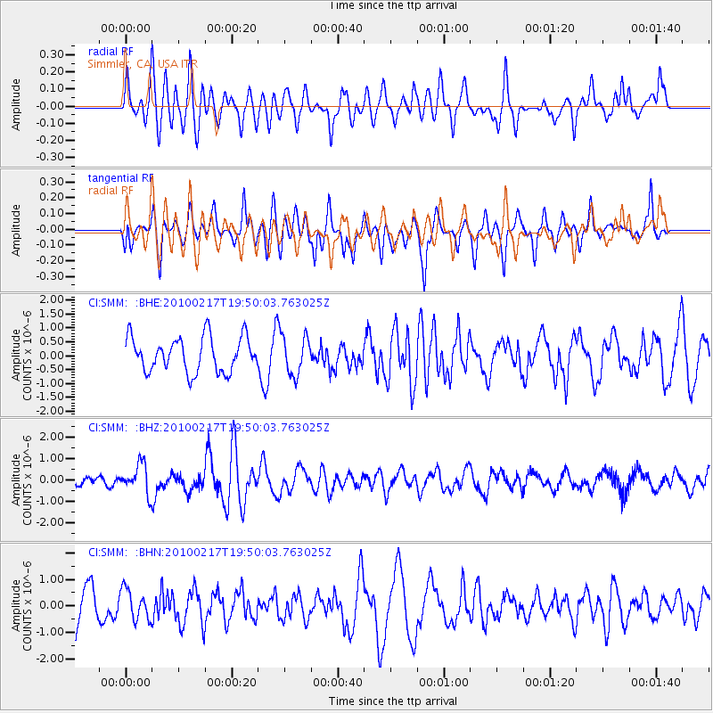
SMM Simmler, CA, USA - Earthquake Result Viewer
*The percent match for this event was below the threshold and hence no stack was calculated.
| Earthquake location: |
Kermadec Islands, New Zealand |
| Earthquake latitude/longitude: |
-29.8/-177.8 |
| Earthquake time(UTC): |
2010/02/17 (048) 19:38:06 GMT |
| Earthquake Depth: |
45 km |
| Earthquake Magnitude: |
5.8 MB, 5.5 MS, 5.9 MW, 5.9 MW |
| Earthquake Catalog/Contributor: |
WHDF/NEIC |
|
| Network: |
CI Caltech Regional Seismic Network |
| Station: |
SMM Simmler, CA, USA |
| Lat/Lon: |
35.31 N/120.00 W |
| Elevation: |
599 m |
|
| Distance: |
84.6 deg |
| Az: |
44.062 deg |
| Baz: |
227.685 deg |
| Ray Param: |
$rayparam |
*The percent match for this event was below the threshold and hence was not used in the summary stack. |
|
| Radial Match: |
48.60003 % |
| Radial Bump: |
400 |
| Transverse Match: |
45.688583 % |
| Transverse Bump: |
400 |
| SOD ConfigId: |
306082 |
| Insert Time: |
2010-05-06 07:43:58.010 +0000 |
| GWidth: |
2.5 |
| Max Bumps: |
400 |
| Tol: |
0.001 |
|
Signal To Noise
| Channel | StoN | STA | LTA |
| CI:SMM: :BHZ:20100217T19:50:03.763025Z | 3.506945 | 7.022805E-7 | 2.0025422E-7 |
| CI:SMM: :BHN:20100217T19:50:03.763025Z | 0.9628917 | 5.8062653E-7 | 6.0300295E-7 |
| CI:SMM: :BHE:20100217T19:50:03.763025Z | 1.1231457 | 6.9859317E-7 | 6.219969E-7 |
| Arrivals |
| Ps | |
| PpPs | |
| PsPs/PpSs | |


