You are here: Home > Network List > G - GEOSCOPE Stations List
> Station INU Inuyama, Japan > Earthquake Result Viewer
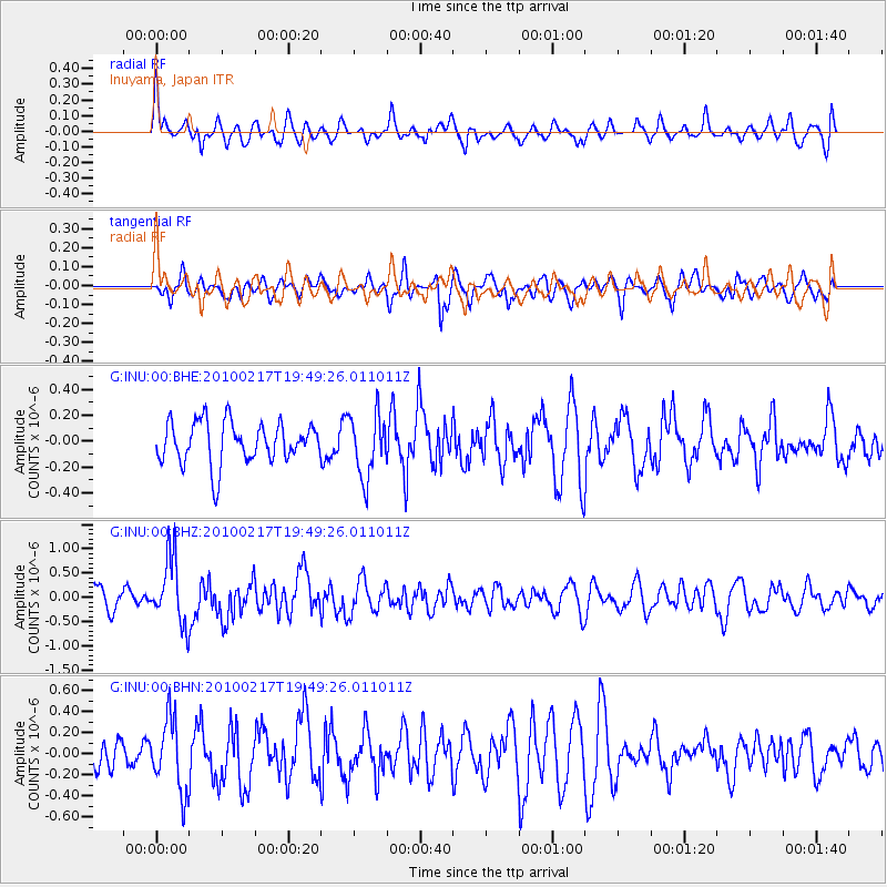
INU Inuyama, Japan - Earthquake Result Viewer
*The percent match for this event was below the threshold and hence no stack was calculated.
| Earthquake location: |
Kermadec Islands, New Zealand |
| Earthquake latitude/longitude: |
-29.8/-177.8 |
| Earthquake time(UTC): |
2010/02/17 (048) 19:38:06 GMT |
| Earthquake Depth: |
45 km |
| Earthquake Magnitude: |
5.8 MB, 5.5 MS, 5.9 MW, 5.9 MW |
| Earthquake Catalog/Contributor: |
WHDF/NEIC |
|
| Network: |
G GEOSCOPE |
| Station: |
INU Inuyama, Japan |
| Lat/Lon: |
35.35 N/137.03 E |
| Elevation: |
132 m |
|
| Distance: |
77.5 deg |
| Az: |
323.591 deg |
| Baz: |
140.848 deg |
| Ray Param: |
$rayparam |
*The percent match for this event was below the threshold and hence was not used in the summary stack. |
|
| Radial Match: |
57.32214 % |
| Radial Bump: |
400 |
| Transverse Match: |
51.739693 % |
| Transverse Bump: |
400 |
| SOD ConfigId: |
306082 |
| Insert Time: |
2010-05-06 07:44:57.271 +0000 |
| GWidth: |
2.5 |
| Max Bumps: |
400 |
| Tol: |
0.001 |
|
Signal To Noise
| Channel | StoN | STA | LTA |
| G:INU:00:BHZ:20100217T19:49:26.011011Z | 2.6108227 | 6.8738706E-7 | 2.632837E-7 |
| G:INU:00:BHN:20100217T19:49:26.011011Z | 1.6012691 | 3.4228663E-7 | 2.1375958E-7 |
| G:INU:00:BHE:20100217T19:49:26.011011Z | 1.5003384 | 2.3935954E-7 | 1.5953704E-7 |
| Arrivals |
| Ps | |
| PpPs | |
| PsPs/PpSs | |


