Z14A Wintersburg, AZ, USA - Earthquake Result Viewer
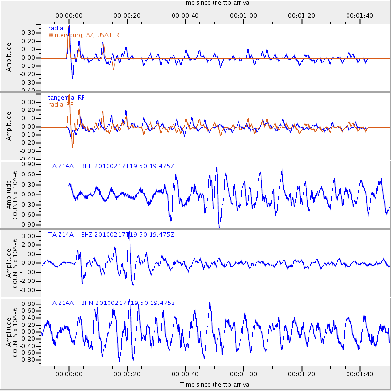
Earthquake location: Kermadec Islands, New Zealand
Earthquake latitude/longitude: -29.8/-177.8
Earthquake time(UTC): 2010/02/17 (048) 19:38:06 GMT
Earthquake Depth: 45 km
Earthquake Magnitude: 5.8 MB, 5.5 MS, 5.9 MW, 5.9 MW
Earthquake Catalog/Contributor: WHDF/NEIC
Network: TA USArray Transportable Network (new EarthScope stations)
Station: Z14A Wintersburg, AZ, USA
Lat/Lon: 33.36 N/112.95 W
Elevation: 298 m
Distance: 87.8 deg
Az: 49.321 deg
Baz: 231.998 deg
Ray Param: 0.0429955
Estimated Moho Depth: 19.5 km
Estimated Crust Vp/Vs: 2.10
Assumed Crust Vp: 6.264 km/s
Estimated Crust Vs: 2.986 km/s
Estimated Crust Poisson's Ratio: 0.35
Radial Match: 87.03017 %
Radial Bump: 400
Transverse Match: 74.13741 %
Transverse Bump: 386
SOD ConfigId: 306082
Insert Time: 2010-05-06 07:47:12.272 +0000
GWidth: 2.5
Max Bumps: 400
Tol: 0.001

Signal To Noise

ChannelStoNSTALTA
TA:Z14A: :BHZ:20100217T19:50:19.475Z3.98605168.3212313E-72.0875875E-7
TA:Z14A: :BHN:20100217T19:50:19.475Z1.81351112.5055238E-71.3815873E-7
TA:Z14A: :BHE:20100217T19:50:19.475Z2.12668542.3365732E-71.0986924E-7
Arrivals
Ps3.5 SECOND
PpPs9.5 SECOND
PsPs/PpSs13 SECOND