You are here: Home > Network List > TA - USArray Transportable Network (new EarthScope stations) Stations List
> Station G05D Wamic, OR, USA > Earthquake Result Viewer
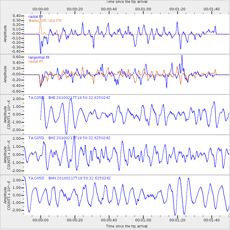
G05D Wamic, OR, USA - Earthquake Result Viewer
*The percent match for this event was below the threshold and hence no stack was calculated.
| Earthquake location: |
Kermadec Islands, New Zealand |
| Earthquake latitude/longitude: |
-29.8/-177.8 |
| Earthquake time(UTC): |
2010/02/17 (048) 19:38:06 GMT |
| Earthquake Depth: |
45 km |
| Earthquake Magnitude: |
5.8 MB, 5.5 MS, 5.9 MW, 5.9 MW |
| Earthquake Catalog/Contributor: |
WHDF/NEIC |
|
| Network: |
TA USArray Transportable Network (new EarthScope stations) |
| Station: |
G05D Wamic, OR, USA |
| Lat/Lon: |
45.24 N/121.32 W |
| Elevation: |
592 m |
|
| Distance: |
90.6 deg |
| Az: |
36.107 deg |
| Baz: |
226.496 deg |
| Ray Param: |
$rayparam |
*The percent match for this event was below the threshold and hence was not used in the summary stack. |
|
| Radial Match: |
41.884228 % |
| Radial Bump: |
400 |
| Transverse Match: |
72.10881 % |
| Transverse Bump: |
308 |
| SOD ConfigId: |
306082 |
| Insert Time: |
2010-05-06 07:50:05.777 +0000 |
| GWidth: |
2.5 |
| Max Bumps: |
400 |
| Tol: |
0.001 |
|
Signal To Noise
| Channel | StoN | STA | LTA |
| TA:G05D: :BHZ:20100217T19:50:32.625024Z | 2.2359834 | 1.060252E-6 | 4.7417709E-7 |
| TA:G05D: :BHN:20100217T19:50:32.625024Z | 0.4507643 | 6.735122E-7 | 1.494156E-6 |
| TA:G05D: :BHE:20100217T19:50:32.625024Z | 0.3357137 | 4.0044281E-7 | 1.1928104E-6 |
| Arrivals |
| Ps | |
| PpPs | |
| PsPs/PpSs | |


