You are here: Home > Network List > US - United States National Seismic Network Stations List
> Station MNTX Cornudas Mountains, Texas, USA > Earthquake Result Viewer
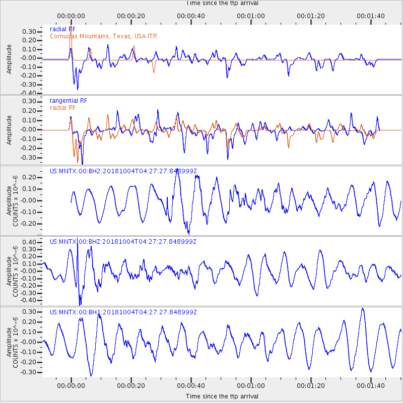
MNTX Cornudas Mountains, Texas, USA - Earthquake Result Viewer
*The percent match for this event was below the threshold and hence no stack was calculated.
| Earthquake location: |
Fiji Islands Region |
| Earthquake latitude/longitude: |
-17.9/-178.5 |
| Earthquake time(UTC): |
2018/10/04 (277) 04:16:21 GMT |
| Earthquake Depth: |
579 km |
| Earthquake Magnitude: |
5.5 Mww |
| Earthquake Catalog/Contributor: |
NEIC PDE/us |
|
| Network: |
US United States National Seismic Network |
| Station: |
MNTX Cornudas Mountains, Texas, USA |
| Lat/Lon: |
31.70 N/105.38 W |
| Elevation: |
404 m |
|
| Distance: |
85.7 deg |
| Az: |
54.903 deg |
| Baz: |
246.086 deg |
| Ray Param: |
$rayparam |
*The percent match for this event was below the threshold and hence was not used in the summary stack. |
|
| Radial Match: |
76.10442 % |
| Radial Bump: |
400 |
| Transverse Match: |
74.082634 % |
| Transverse Bump: |
400 |
| SOD ConfigId: |
3045211 |
| Insert Time: |
2018-10-18 04:32:06.245 +0000 |
| GWidth: |
2.5 |
| Max Bumps: |
400 |
| Tol: |
0.001 |
|
Signal To Noise
| Channel | StoN | STA | LTA |
| US:MNTX:00:BHZ:20181004T04:27:27.848999Z | 1.5526862 | 2.5304522E-7 | 1.6297254E-7 |
| US:MNTX:00:BH1:20181004T04:27:27.848999Z | 1.3581066 | 1.5509285E-7 | 1.14197846E-7 |
| US:MNTX:00:BH2:20181004T04:27:27.848999Z | 0.9143432 | 9.207571E-8 | 1.0070148E-7 |
| Arrivals |
| Ps | |
| PpPs | |
| PsPs/PpSs | |


