You are here: Home > Network List > CN - Canadian National Seismograph Network Stations List
> Station INK INUVIK, NT > Earthquake Result Viewer
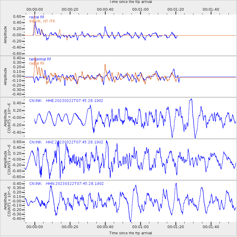
INK INUVIK, NT - Earthquake Result Viewer
*The percent match for this event was below the threshold and hence no stack was calculated.
| Earthquake location: |
Off East Coast Of Honshu, Japan |
| Earthquake latitude/longitude: |
40.3/143.0 |
| Earthquake time(UTC): |
2023/03/22 (081) 07:37:01 GMT |
| Earthquake Depth: |
35 km |
| Earthquake Magnitude: |
5.6 Mww |
| Earthquake Catalog/Contributor: |
NEIC PDE/us |
|
| Network: |
CN Canadian National Seismograph Network |
| Station: |
INK INUVIK, NT |
| Lat/Lon: |
68.31 N/133.53 W |
| Elevation: |
44 m |
|
| Distance: |
50.9 deg |
| Az: |
28.419 deg |
| Baz: |
281.778 deg |
| Ray Param: |
$rayparam |
*The percent match for this event was below the threshold and hence was not used in the summary stack. |
|
| Radial Match: |
52.803947 % |
| Radial Bump: |
400 |
| Transverse Match: |
63.801662 % |
| Transverse Bump: |
361 |
| SOD ConfigId: |
30536071 |
| Insert Time: |
2023-04-05 07:47:10.048 +0000 |
| GWidth: |
2.5 |
| Max Bumps: |
400 |
| Tol: |
0.001 |
|
Signal To Noise
| Channel | StoN | STA | LTA |
| CN:INK: :HHZ:20230322T07:45:28.190Z | 1.4920592 | 2.729596E-7 | 1.8294153E-7 |
| CN:INK: :HHN:20230322T07:45:28.190Z | 0.33044997 | 5.3086055E-8 | 1.6064779E-7 |
| CN:INK: :HHE:20230322T07:45:28.190Z | 2.2074428 | 2.355981E-7 | 1.0672896E-7 |
| Arrivals |
| Ps | |
| PpPs | |
| PsPs/PpSs | |


