You are here: Home > Network List > IW - Intermountain West Stations List
> Station PLID Pearl Lake, Idaho, USA > Earthquake Result Viewer
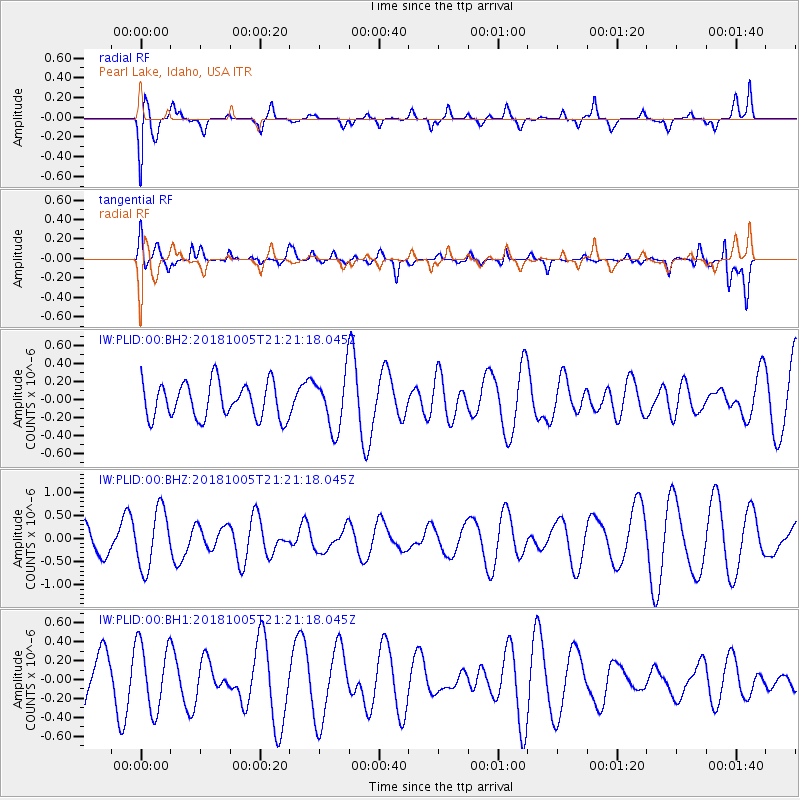
PLID Pearl Lake, Idaho, USA - Earthquake Result Viewer
*The percent match for this event was below the threshold and hence no stack was calculated.
| Earthquake location: |
Southeast Of Loyalty Islands |
| Earthquake latitude/longitude: |
-22.0/169.6 |
| Earthquake time(UTC): |
2018/10/05 (278) 21:08:26 GMT |
| Earthquake Depth: |
5.6 km |
| Earthquake Magnitude: |
5.4 Mww |
| Earthquake Catalog/Contributor: |
NEIC PDE/us |
|
| Network: |
IW Intermountain West |
| Station: |
PLID Pearl Lake, Idaho, USA |
| Lat/Lon: |
45.09 N/116.00 W |
| Elevation: |
2164 m |
|
| Distance: |
94.9 deg |
| Az: |
43.222 deg |
| Baz: |
243.806 deg |
| Ray Param: |
$rayparam |
*The percent match for this event was below the threshold and hence was not used in the summary stack. |
|
| Radial Match: |
36.123264 % |
| Radial Bump: |
400 |
| Transverse Match: |
64.78446 % |
| Transverse Bump: |
400 |
| SOD ConfigId: |
3045211 |
| Insert Time: |
2018-10-20 23:24:42.504 +0000 |
| GWidth: |
2.5 |
| Max Bumps: |
400 |
| Tol: |
0.001 |
|
Signal To Noise
| Channel | StoN | STA | LTA |
| IW:PLID:00:BHZ:20181005T21:21:18.045Z | 1.9974548 | 6.341665E-7 | 3.1748726E-7 |
| IW:PLID:00:BH1:20181005T21:21:18.045Z | 0.93689257 | 3.5534026E-7 | 3.7927538E-7 |
| IW:PLID:00:BH2:20181005T21:21:18.045Z | 1.5265859 | 2.985579E-7 | 1.9557228E-7 |
| Arrivals |
| Ps | |
| PpPs | |
| PsPs/PpSs | |


