You are here: Home > Network List > UU - University of Utah Regional Network Stations List
> Station CCUT Cedar City, UT, USA > Earthquake Result Viewer
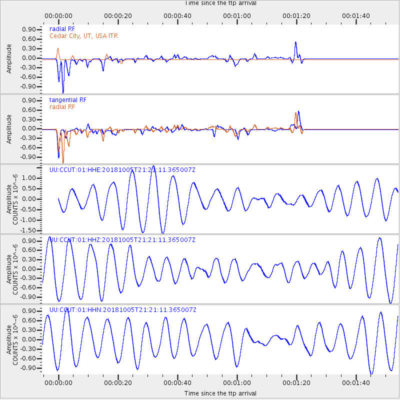
CCUT Cedar City, UT, USA - Earthquake Result Viewer
*The percent match for this event was below the threshold and hence no stack was calculated.
| Earthquake location: |
Southeast Of Loyalty Islands |
| Earthquake latitude/longitude: |
-22.0/169.6 |
| Earthquake time(UTC): |
2018/10/05 (278) 21:08:26 GMT |
| Earthquake Depth: |
5.6 km |
| Earthquake Magnitude: |
5.4 Mww |
| Earthquake Catalog/Contributor: |
NEIC PDE/us |
|
| Network: |
UU University of Utah Regional Network |
| Station: |
CCUT Cedar City, UT, USA |
| Lat/Lon: |
37.55 N/113.36 W |
| Elevation: |
2127 m |
|
| Distance: |
93.5 deg |
| Az: |
50.891 deg |
| Baz: |
244.983 deg |
| Ray Param: |
$rayparam |
*The percent match for this event was below the threshold and hence was not used in the summary stack. |
|
| Radial Match: |
81.59067 % |
| Radial Bump: |
400 |
| Transverse Match: |
78.01301 % |
| Transverse Bump: |
312 |
| SOD ConfigId: |
3045211 |
| Insert Time: |
2018-10-20 23:25:33.347 +0000 |
| GWidth: |
2.5 |
| Max Bumps: |
400 |
| Tol: |
0.001 |
|
Signal To Noise
| Channel | StoN | STA | LTA |
| UU:CCUT:01:HHZ:20181005T21:21:11.365007Z | 1.4921535 | 7.5428716E-7 | 5.055024E-7 |
| UU:CCUT:01:HHN:20181005T21:21:11.365007Z | 2.0573142 | 7.131938E-7 | 3.4666257E-7 |
| UU:CCUT:01:HHE:20181005T21:21:11.365007Z | 1.7259966 | 1.0747134E-6 | 6.226625E-7 |
| Arrivals |
| Ps | |
| PpPs | |
| PsPs/PpSs | |


