You are here: Home > Network List > TA - USArray Transportable Network (new EarthScope stations) Stations List
> Station 319A Douglas, AZ, USA > Earthquake Result Viewer
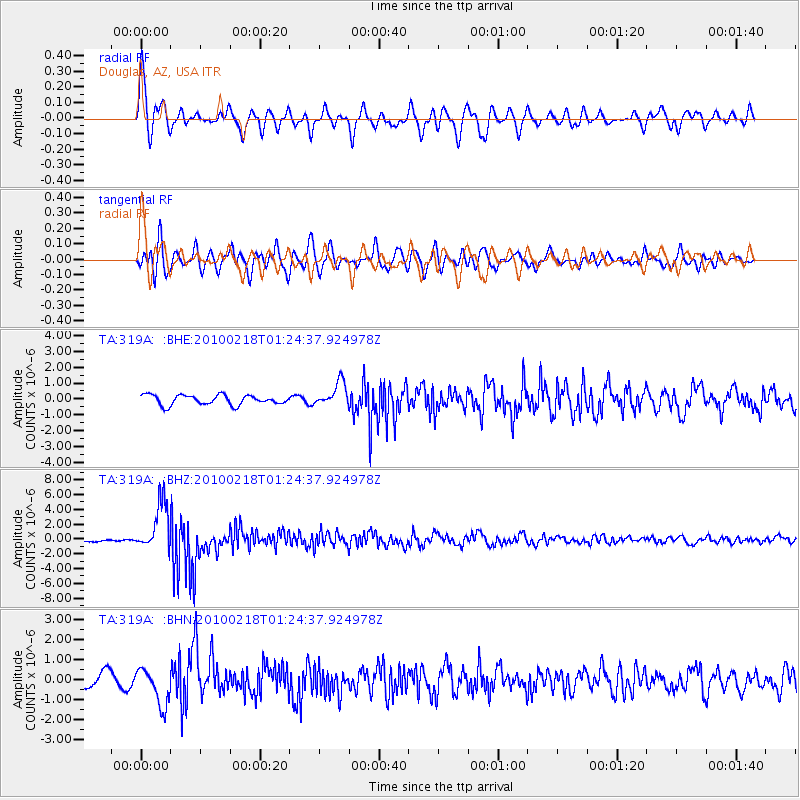
319A Douglas, AZ, USA - Earthquake Result Viewer
*The percent match for this event was below the threshold and hence no stack was calculated.
| Earthquake location: |
E. Russia-N.E. China Border Reg. |
| Earthquake latitude/longitude: |
42.6/130.7 |
| Earthquake time(UTC): |
2010/02/18 (049) 01:13:19 GMT |
| Earthquake Depth: |
578 km |
| Earthquake Magnitude: |
6.3 MB, 6.9 MW, 6.9 MW |
| Earthquake Catalog/Contributor: |
WHDF/NEIC |
|
| Network: |
TA USArray Transportable Network (new EarthScope stations) |
| Station: |
319A Douglas, AZ, USA |
| Lat/Lon: |
31.38 N/109.28 W |
| Elevation: |
1187 m |
|
| Distance: |
88.1 deg |
| Az: |
47.818 deg |
| Baz: |
320.222 deg |
| Ray Param: |
$rayparam |
*The percent match for this event was below the threshold and hence was not used in the summary stack. |
|
| Radial Match: |
77.99566 % |
| Radial Bump: |
400 |
| Transverse Match: |
77.13363 % |
| Transverse Bump: |
400 |
| SOD ConfigId: |
306082 |
| Insert Time: |
2010-05-06 08:13:21.363 +0000 |
| GWidth: |
2.5 |
| Max Bumps: |
400 |
| Tol: |
0.001 |
|
Signal To Noise
| Channel | StoN | STA | LTA |
| TA:319A: :BHZ:20100218T01:24:37.924978Z | 12.691011 | 3.2826792E-6 | 2.5866174E-7 |
| TA:319A: :BHN:20100218T01:24:37.924978Z | 2.2288582 | 9.1721967E-7 | 4.1151998E-7 |
| TA:319A: :BHE:20100218T01:24:37.924978Z | 2.5253854 | 7.73037E-7 | 3.0610656E-7 |
| Arrivals |
| Ps | |
| PpPs | |
| PsPs/PpSs | |


