You are here: Home > Network List > US - United States National Seismic Network Stations List
> Station MNTX Cornudas Mountains, Texas, USA > Earthquake Result Viewer
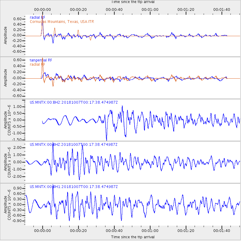
MNTX Cornudas Mountains, Texas, USA - Earthquake Result Viewer
*The percent match for this event was below the threshold and hence no stack was calculated.
| Earthquake location: |
Haiti Region |
| Earthquake latitude/longitude: |
20.0/-73.0 |
| Earthquake time(UTC): |
2018/10/07 (280) 00:11:49 GMT |
| Earthquake Depth: |
12 km |
| Earthquake Magnitude: |
5.9 Mww |
| Earthquake Catalog/Contributor: |
NEIC PDE/us |
|
| Network: |
US United States National Seismic Network |
| Station: |
MNTX Cornudas Mountains, Texas, USA |
| Lat/Lon: |
31.70 N/105.38 W |
| Elevation: |
404 m |
|
| Distance: |
31.3 deg |
| Az: |
298.347 deg |
| Baz: |
103.897 deg |
| Ray Param: |
$rayparam |
*The percent match for this event was below the threshold and hence was not used in the summary stack. |
|
| Radial Match: |
69.05366 % |
| Radial Bump: |
352 |
| Transverse Match: |
55.88232 % |
| Transverse Bump: |
400 |
| SOD ConfigId: |
3045211 |
| Insert Time: |
2018-10-21 00:30:36.754 +0000 |
| GWidth: |
2.5 |
| Max Bumps: |
400 |
| Tol: |
0.001 |
|
Signal To Noise
| Channel | StoN | STA | LTA |
| US:MNTX:00:BHZ:20181007T00:17:38.474987Z | 3.5327768 | 4.814418E-7 | 1.3627859E-7 |
| US:MNTX:00:BH1:20181007T00:17:38.474987Z | 0.5066772 | 1.4992983E-7 | 2.95908E-7 |
| US:MNTX:00:BH2:20181007T00:17:38.474987Z | 0.93859655 | 1.7145558E-7 | 1.826723E-7 |
| Arrivals |
| Ps | |
| PpPs | |
| PsPs/PpSs | |


