You are here: Home > Network List > US - United States National Seismic Network Stations List
> Station WMOK Wichita Mountains, Oklahoma, USA > Earthquake Result Viewer
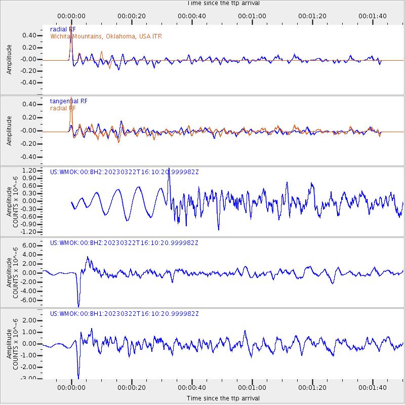
WMOK Wichita Mountains, Oklahoma, USA - Earthquake Result Viewer
*The percent match for this event was below the threshold and hence no stack was calculated.
| Earthquake location: |
Jujuy Province, Argentina |
| Earthquake latitude/longitude: |
-23.5/-66.5 |
| Earthquake time(UTC): |
2023/03/22 (081) 16:00:31 GMT |
| Earthquake Depth: |
210 km |
| Earthquake Magnitude: |
6.5 mww |
| Earthquake Catalog/Contributor: |
NEIC PDE/us |
|
| Network: |
US United States National Seismic Network |
| Station: |
WMOK Wichita Mountains, Oklahoma, USA |
| Lat/Lon: |
34.74 N/98.78 W |
| Elevation: |
486 m |
|
| Distance: |
65.5 deg |
| Az: |
331.105 deg |
| Baz: |
147.404 deg |
| Ray Param: |
$rayparam |
*The percent match for this event was below the threshold and hence was not used in the summary stack. |
|
| Radial Match: |
75.84122 % |
| Radial Bump: |
400 |
| Transverse Match: |
62.690113 % |
| Transverse Bump: |
400 |
| SOD ConfigId: |
30536071 |
| Insert Time: |
2023-04-05 16:33:18.163 +0000 |
| GWidth: |
2.5 |
| Max Bumps: |
400 |
| Tol: |
0.001 |
|
Signal To Noise
| Channel | StoN | STA | LTA |
| US:WMOK:00:BHZ:20230322T16:10:20.999982Z | 6.545882 | 2.614383E-6 | 3.993935E-7 |
| US:WMOK:00:BH1:20230322T16:10:20.999982Z | 5.8156924 | 9.771165E-7 | 1.680138E-7 |
| US:WMOK:00:BH2:20230322T16:10:20.999982Z | 1.504833 | 5.0209525E-7 | 3.3365512E-7 |
| Arrivals |
| Ps | |
| PpPs | |
| PsPs/PpSs | |


