You are here: Home > Network List > GS - US Geological Survey Networks Stations List
> Station OK031 S. Brethren Rd., Cushing, OK, USA > Earthquake Result Viewer
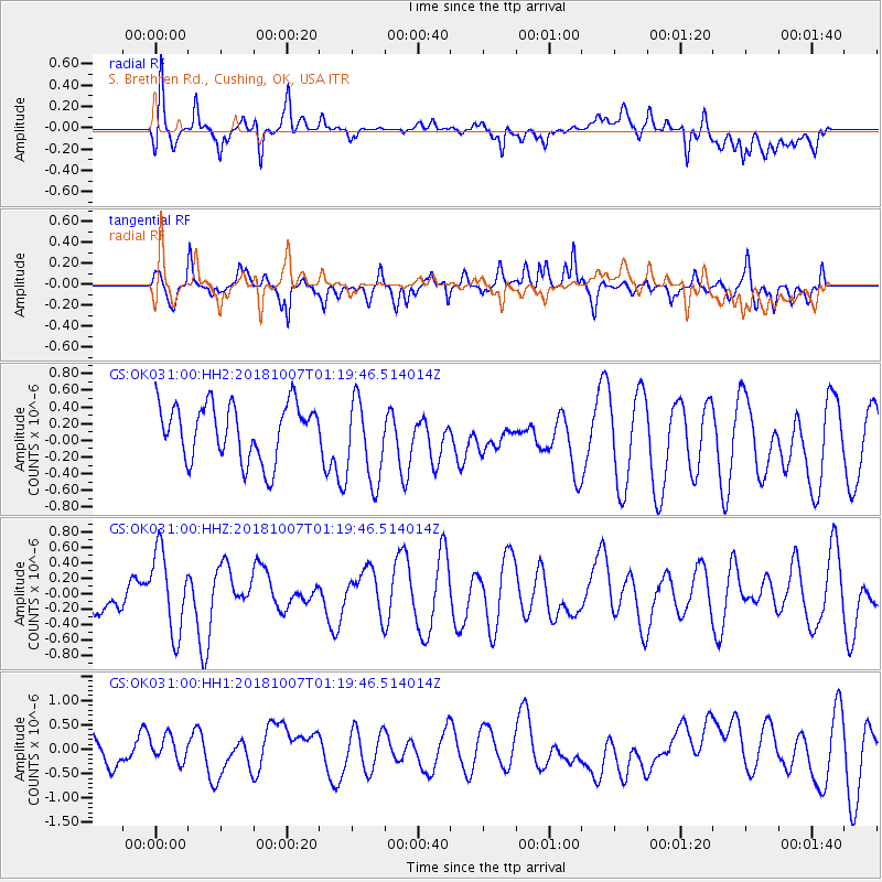
OK031 S. Brethren Rd., Cushing, OK, USA - Earthquake Result Viewer
*The percent match for this event was below the threshold and hence no stack was calculated.
| Earthquake location: |
Pacific-Antarctic Ridge |
| Earthquake latitude/longitude: |
-54.4/-135.5 |
| Earthquake time(UTC): |
2018/10/07 (280) 01:06:51 GMT |
| Earthquake Depth: |
10 km |
| Earthquake Magnitude: |
5.6 Mww |
| Earthquake Catalog/Contributor: |
NEIC PDE/us |
|
| Network: |
GS US Geological Survey Networks |
| Station: |
OK031 S. Brethren Rd., Cushing, OK, USA |
| Lat/Lon: |
35.95 N/96.84 W |
| Elevation: |
290 m |
|
| Distance: |
96.0 deg |
| Az: |
30.66 deg |
| Baz: |
201.558 deg |
| Ray Param: |
$rayparam |
*The percent match for this event was below the threshold and hence was not used in the summary stack. |
|
| Radial Match: |
65.80762 % |
| Radial Bump: |
400 |
| Transverse Match: |
53.000065 % |
| Transverse Bump: |
400 |
| SOD ConfigId: |
3045211 |
| Insert Time: |
2018-10-21 01:18:56.923 +0000 |
| GWidth: |
2.5 |
| Max Bumps: |
400 |
| Tol: |
0.001 |
|
Signal To Noise
| Channel | StoN | STA | LTA |
| GS:OK031:00:HHZ:20181007T01:19:46.514014Z | 1.7585999 | 5.237789E-7 | 2.978386E-7 |
| GS:OK031:00:HH1:20181007T01:19:46.514014Z | 1.1183316 | 2.6117166E-7 | 2.3353688E-7 |
| GS:OK031:00:HH2:20181007T01:19:46.514014Z | 1.5286356 | 5.096982E-7 | 3.334334E-7 |
| Arrivals |
| Ps | |
| PpPs | |
| PsPs/PpSs | |


