You are here: Home > Network List > US - United States National Seismic Network Stations List
> Station MSO Missoula, Montana, USA > Earthquake Result Viewer
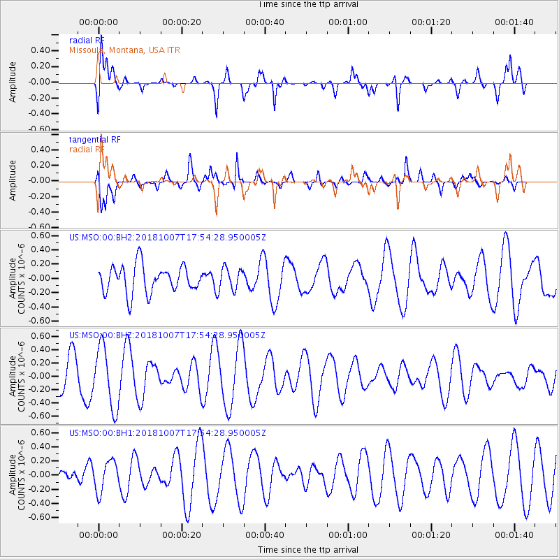
MSO Missoula, Montana, USA - Earthquake Result Viewer
*The percent match for this event was below the threshold and hence no stack was calculated.
| Earthquake location: |
Kermadec Islands Region |
| Earthquake latitude/longitude: |
-28.2/-179.3 |
| Earthquake time(UTC): |
2018/10/07 (280) 17:42:21 GMT |
| Earthquake Depth: |
395 km |
| Earthquake Magnitude: |
5.5 Mww |
| Earthquake Catalog/Contributor: |
NEIC PDE/us |
|
| Network: |
US United States National Seismic Network |
| Station: |
MSO Missoula, Montana, USA |
| Lat/Lon: |
46.83 N/113.94 W |
| Elevation: |
1264 m |
|
| Distance: |
95.1 deg |
| Az: |
38.789 deg |
| Baz: |
233.658 deg |
| Ray Param: |
$rayparam |
*The percent match for this event was below the threshold and hence was not used in the summary stack. |
|
| Radial Match: |
65.303215 % |
| Radial Bump: |
400 |
| Transverse Match: |
70.55429 % |
| Transverse Bump: |
400 |
| SOD ConfigId: |
3045211 |
| Insert Time: |
2018-10-21 17:56:42.321 +0000 |
| GWidth: |
2.5 |
| Max Bumps: |
400 |
| Tol: |
0.001 |
|
Signal To Noise
| Channel | StoN | STA | LTA |
| US:MSO:00:BHZ:20181007T17:54:28.950005Z | 2.0174758 | 4.7175388E-7 | 2.338337E-7 |
| US:MSO:00:BH1:20181007T17:54:28.950005Z | 0.856509 | 2.2203457E-7 | 2.5923202E-7 |
| US:MSO:00:BH2:20181007T17:54:28.950005Z | 0.78119236 | 1.4973527E-7 | 1.916753E-7 |
| Arrivals |
| Ps | |
| PpPs | |
| PsPs/PpSs | |


