You are here: Home > Network List > TA - USArray Transportable Network (new EarthScope stations) Stations List
> Station M26A McRoberts Ranch, Bridgeport, NE, USA > Earthquake Result Viewer
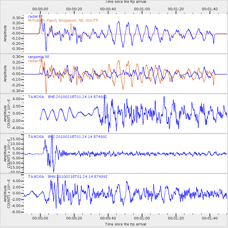
M26A McRoberts Ranch, Bridgeport, NE, USA - Earthquake Result Viewer
*The percent match for this event was below the threshold and hence no stack was calculated.
| Earthquake location: |
E. Russia-N.E. China Border Reg. |
| Earthquake latitude/longitude: |
42.6/130.7 |
| Earthquake time(UTC): |
2010/02/18 (049) 01:13:19 GMT |
| Earthquake Depth: |
578 km |
| Earthquake Magnitude: |
6.3 MB, 6.9 MW, 6.9 MW |
| Earthquake Catalog/Contributor: |
WHDF/NEIC |
|
| Network: |
TA USArray Transportable Network (new EarthScope stations) |
| Station: |
M26A McRoberts Ranch, Bridgeport, NE, USA |
| Lat/Lon: |
41.47 N/103.14 W |
| Elevation: |
1348 m |
|
| Distance: |
83.3 deg |
| Az: |
37.665 deg |
| Baz: |
323.098 deg |
| Ray Param: |
$rayparam |
*The percent match for this event was below the threshold and hence was not used in the summary stack. |
|
| Radial Match: |
76.871735 % |
| Radial Bump: |
400 |
| Transverse Match: |
71.68788 % |
| Transverse Bump: |
400 |
| SOD ConfigId: |
306082 |
| Insert Time: |
2010-05-06 08:29:35.745 +0000 |
| GWidth: |
2.5 |
| Max Bumps: |
400 |
| Tol: |
0.001 |
|
Signal To Noise
| Channel | StoN | STA | LTA |
| TA:M26A: :BHZ:20100218T01:24:14.87499Z | 21.65783 | 5.8138457E-6 | 2.6844083E-7 |
| TA:M26A: :BHN:20100218T01:24:14.87499Z | 3.5529766 | 1.3594561E-6 | 3.8262456E-7 |
| TA:M26A: :BHE:20100218T01:24:14.87499Z | 1.0744308 | 1.0782732E-6 | 1.0035761E-6 |
| Arrivals |
| Ps | |
| PpPs | |
| PsPs/PpSs | |


