You are here: Home > Network List > TA - USArray Transportable Network (new EarthScope stations) Stations List
> Station 332A Millersview, TX, USA > Earthquake Result Viewer
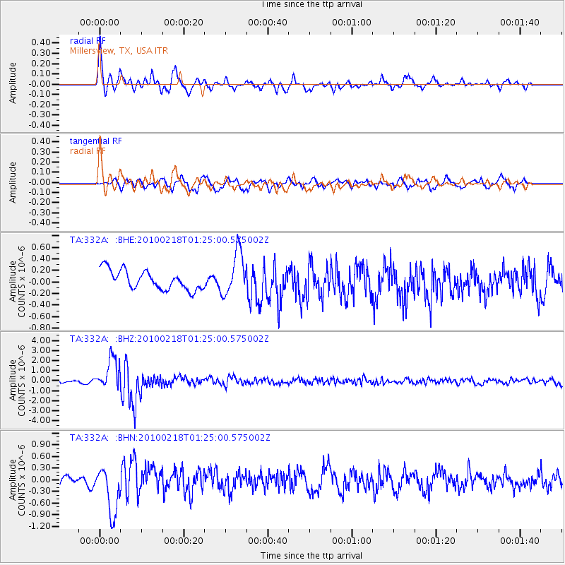
332A Millersview, TX, USA - Earthquake Result Viewer
*The percent match for this event was below the threshold and hence no stack was calculated.
| Earthquake location: |
E. Russia-N.E. China Border Reg. |
| Earthquake latitude/longitude: |
42.6/130.7 |
| Earthquake time(UTC): |
2010/02/18 (049) 01:13:19 GMT |
| Earthquake Depth: |
578 km |
| Earthquake Magnitude: |
6.3 MB, 6.9 MW, 6.9 MW |
| Earthquake Catalog/Contributor: |
WHDF/NEIC |
|
| Network: |
TA USArray Transportable Network (new EarthScope stations) |
| Station: |
332A Millersview, TX, USA |
| Lat/Lon: |
31.38 N/99.74 W |
| Elevation: |
513 m |
|
| Distance: |
93.0 deg |
| Az: |
41.326 deg |
| Baz: |
325.236 deg |
| Ray Param: |
$rayparam |
*The percent match for this event was below the threshold and hence was not used in the summary stack. |
|
| Radial Match: |
69.421906 % |
| Radial Bump: |
400 |
| Transverse Match: |
72.492424 % |
| Transverse Bump: |
400 |
| SOD ConfigId: |
306082 |
| Insert Time: |
2010-05-06 08:34:16.035 +0000 |
| GWidth: |
2.5 |
| Max Bumps: |
400 |
| Tol: |
0.001 |
|
Signal To Noise
| Channel | StoN | STA | LTA |
| TA:332A: :BHZ:20100218T01:25:00.575002Z | 8.400941 | 1.6018781E-6 | 1.9067842E-7 |
| TA:332A: :BHN:20100218T01:25:00.575002Z | 4.351348 | 6.222998E-7 | 1.4301311E-7 |
| TA:332A: :BHE:20100218T01:25:00.575002Z | 2.3197157 | 3.8703223E-7 | 1.6684467E-7 |
| Arrivals |
| Ps | |
| PpPs | |
| PsPs/PpSs | |


