You are here: Home > Network List > IU - Global Seismograph Network (GSN - IRIS/USGS) Stations List
> Station PMG Port Moresby, New Guinea > Earthquake Result Viewer
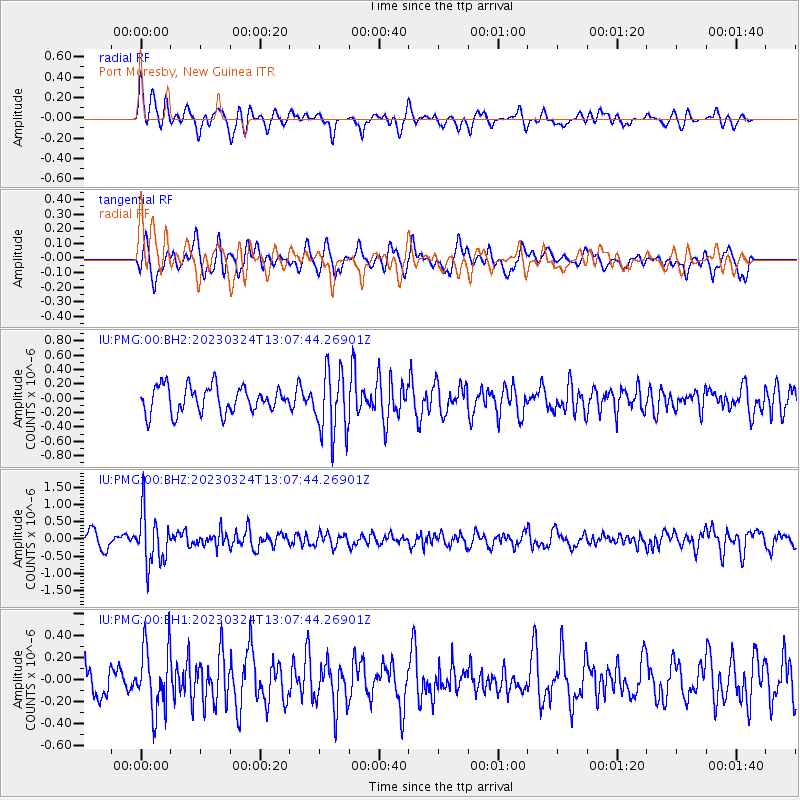
PMG Port Moresby, New Guinea - Earthquake Result Viewer
*The percent match for this event was below the threshold and hence no stack was calculated.
| Earthquake location: |
Fiji Islands Region |
| Earthquake latitude/longitude: |
-20.3/-176.6 |
| Earthquake time(UTC): |
2023/03/24 (083) 13:01:34 GMT |
| Earthquake Depth: |
281 km |
| Earthquake Magnitude: |
5.6 Mww |
| Earthquake Catalog/Contributor: |
NEIC PDE/us |
|
| Network: |
IU Global Seismograph Network (GSN - IRIS/USGS) |
| Station: |
PMG Port Moresby, New Guinea |
| Lat/Lon: |
9.40 S/147.16 E |
| Elevation: |
90 m |
|
| Distance: |
36.6 deg |
| Az: |
281.785 deg |
| Baz: |
111.363 deg |
| Ray Param: |
$rayparam |
*The percent match for this event was below the threshold and hence was not used in the summary stack. |
|
| Radial Match: |
71.65468 % |
| Radial Bump: |
400 |
| Transverse Match: |
62.320065 % |
| Transverse Bump: |
400 |
| SOD ConfigId: |
30536071 |
| Insert Time: |
2023-04-07 13:13:18.596 +0000 |
| GWidth: |
2.5 |
| Max Bumps: |
400 |
| Tol: |
0.001 |
|
Signal To Noise
| Channel | StoN | STA | LTA |
| IU:PMG:00:BHZ:20230324T13:07:44.26901Z | 3.3670354 | 7.544685E-7 | 2.2407501E-7 |
| IU:PMG:00:BH1:20230324T13:07:44.26901Z | 2.6754217 | 2.9477067E-7 | 1.10177275E-7 |
| IU:PMG:00:BH2:20230324T13:07:44.26901Z | 2.4535003 | 4.497325E-7 | 1.833024E-7 |
| Arrivals |
| Ps | |
| PpPs | |
| PsPs/PpSs | |


