You are here: Home > Network List > UW - Pacific Northwest Regional Seismic Network Stations List
> Station HOOD Mt Hood Meadows, OR CREST BB SMO > Earthquake Result Viewer
HOOD Mt Hood Meadows, OR CREST BB SMO - Earthquake Result Viewer
*The percent match for this event was below the threshold and hence no stack was calculated.
| Earthquake location: |
Fiji Islands Region |
| Earthquake latitude/longitude: |
-20.3/-176.6 |
| Earthquake time(UTC): |
2023/03/24 (083) 13:01:34 GMT |
| Earthquake Depth: |
281 km |
| Earthquake Magnitude: |
5.6 Mww |
| Earthquake Catalog/Contributor: |
NEIC PDE/us |
|
| Network: |
UW Pacific Northwest Regional Seismic Network |
| Station: |
HOOD Mt Hood Meadows, OR CREST BB SMO |
| Lat/Lon: |
45.32 N/121.65 W |
| Elevation: |
1520 m |
|
| Distance: |
82.2 deg |
| Az: |
35.646 deg |
| Baz: |
230.844 deg |
| Ray Param: |
$rayparam |
*The percent match for this event was below the threshold and hence was not used in the summary stack. |
|
| Radial Match: |
42.312088 % |
| Radial Bump: |
400 |
| Transverse Match: |
52.593544 % |
| Transverse Bump: |
400 |
| SOD ConfigId: |
30536071 |
| Insert Time: |
2023-04-07 13:22:10.928 +0000 |
| GWidth: |
2.5 |
| Max Bumps: |
400 |
| Tol: |
0.001 |
|
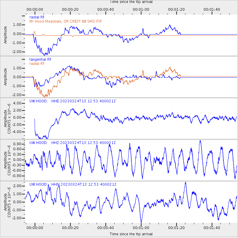
Signal To Noise
| Channel | StoN | STA | LTA |
| UW:HOOD: :HHZ:20230324T13:12:53.400021Z | 0.7898841 | 2.4557295E-7 | 3.1089743E-7 |
| UW:HOOD: :HHN:20230324T13:12:53.400021Z | 2.640164 | 1.9449428E-6 | 7.36675E-7 |
| UW:HOOD: :HHE:20230324T13:12:53.400021Z | 0.7785585 | 2.3064076E-6 | 2.9624077E-6 |
| Arrivals |
| Ps | |
| PpPs | |
| PsPs/PpSs | |


