You are here: Home > Network List > IW - Intermountain West Stations List
> Station MOOW Moose Ponds, Wyoming, USA > Earthquake Result Viewer
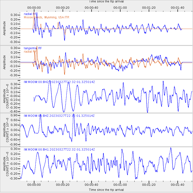
MOOW Moose Ponds, Wyoming, USA - Earthquake Result Viewer
*The percent match for this event was below the threshold and hence no stack was calculated.
| Earthquake location: |
Solomon Islands |
| Earthquake latitude/longitude: |
-8.2/158.9 |
| Earthquake time(UTC): |
2023/03/27 (086) 22:19:15 GMT |
| Earthquake Depth: |
86 km |
| Earthquake Magnitude: |
6.1 mww |
| Earthquake Catalog/Contributor: |
NEIC PDE/us |
|
| Network: |
IW Intermountain West |
| Station: |
MOOW Moose Ponds, Wyoming, USA |
| Lat/Lon: |
43.75 N/110.74 W |
| Elevation: |
2128 m |
|
| Distance: |
95.8 deg |
| Az: |
46.759 deg |
| Baz: |
264.294 deg |
| Ray Param: |
$rayparam |
*The percent match for this event was below the threshold and hence was not used in the summary stack. |
|
| Radial Match: |
67.88385 % |
| Radial Bump: |
400 |
| Transverse Match: |
57.696682 % |
| Transverse Bump: |
400 |
| SOD ConfigId: |
30536071 |
| Insert Time: |
2023-04-10 22:36:22.003 +0000 |
| GWidth: |
2.5 |
| Max Bumps: |
400 |
| Tol: |
0.001 |
|
Signal To Noise
| Channel | StoN | STA | LTA |
| IW:MOOW:00:BHZ:20230327T22:32:01.325014Z | 1.7473452 | 3.8702055E-7 | 2.2149061E-7 |
| IW:MOOW:00:BH1:20230327T22:32:01.325014Z | 1.2363371 | 1.6067288E-7 | 1.299588E-7 |
| IW:MOOW:00:BH2:20230327T22:32:01.325014Z | 0.8848016 | 1.8250344E-7 | 2.0626482E-7 |
| Arrivals |
| Ps | |
| PpPs | |
| PsPs/PpSs | |


