You are here: Home > Network List > US - United States National Seismic Network Stations List
> Station ERPA Erie, Pennsylvania, USA > Earthquake Result Viewer
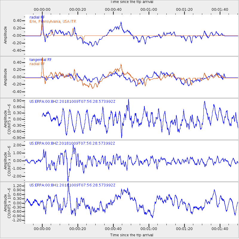
ERPA Erie, Pennsylvania, USA - Earthquake Result Viewer
*The percent match for this event was below the threshold and hence no stack was calculated.
| Earthquake location: |
Kuril Islands |
| Earthquake latitude/longitude: |
49.4/156.2 |
| Earthquake time(UTC): |
2018/10/09 (282) 07:45:14 GMT |
| Earthquake Depth: |
42 km |
| Earthquake Magnitude: |
6.0 Mww |
| Earthquake Catalog/Contributor: |
NEIC PDE/us |
|
| Network: |
US United States National Seismic Network |
| Station: |
ERPA Erie, Pennsylvania, USA |
| Lat/Lon: |
42.12 N/79.99 W |
| Elevation: |
306 m |
|
| Distance: |
76.4 deg |
| Az: |
39.484 deg |
| Baz: |
326.083 deg |
| Ray Param: |
$rayparam |
*The percent match for this event was below the threshold and hence was not used in the summary stack. |
|
| Radial Match: |
72.919014 % |
| Radial Bump: |
400 |
| Transverse Match: |
60.456512 % |
| Transverse Bump: |
400 |
| SOD ConfigId: |
3045211 |
| Insert Time: |
2018-10-23 08:04:50.851 +0000 |
| GWidth: |
2.5 |
| Max Bumps: |
400 |
| Tol: |
0.001 |
|
Signal To Noise
| Channel | StoN | STA | LTA |
| US:ERPA:00:BHZ:20181009T07:56:28.573992Z | 4.0723667 | 7.707361E-7 | 1.8925999E-7 |
| US:ERPA:00:BH1:20181009T07:56:28.573992Z | 1.9167553 | 3.7040175E-7 | 1.9324415E-7 |
| US:ERPA:00:BH2:20181009T07:56:28.573992Z | 0.6974954 | 2.2221556E-7 | 3.185907E-7 |
| Arrivals |
| Ps | |
| PpPs | |
| PsPs/PpSs | |


