You are here: Home > Network List > US - United States National Seismic Network Stations List
> Station WMOK Wichita Mountains, Oklahoma, USA > Earthquake Result Viewer
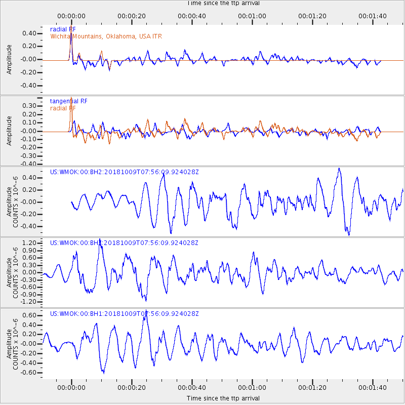
WMOK Wichita Mountains, Oklahoma, USA - Earthquake Result Viewer
*The percent match for this event was below the threshold and hence no stack was calculated.
| Earthquake location: |
Kuril Islands |
| Earthquake latitude/longitude: |
49.4/156.2 |
| Earthquake time(UTC): |
2018/10/09 (282) 07:45:14 GMT |
| Earthquake Depth: |
42 km |
| Earthquake Magnitude: |
6.0 Mww |
| Earthquake Catalog/Contributor: |
NEIC PDE/us |
|
| Network: |
US United States National Seismic Network |
| Station: |
WMOK Wichita Mountains, Oklahoma, USA |
| Lat/Lon: |
34.74 N/98.78 W |
| Elevation: |
486 m |
|
| Distance: |
73.1 deg |
| Az: |
56.205 deg |
| Baz: |
318.79 deg |
| Ray Param: |
$rayparam |
*The percent match for this event was below the threshold and hence was not used in the summary stack. |
|
| Radial Match: |
54.05786 % |
| Radial Bump: |
400 |
| Transverse Match: |
52.621277 % |
| Transverse Bump: |
400 |
| SOD ConfigId: |
3045211 |
| Insert Time: |
2018-10-23 08:05:32.830 +0000 |
| GWidth: |
2.5 |
| Max Bumps: |
400 |
| Tol: |
0.001 |
|
Signal To Noise
| Channel | StoN | STA | LTA |
| US:WMOK:00:BHZ:20181009T07:56:09.924028Z | 5.007962 | 4.4530196E-7 | 8.8918796E-8 |
| US:WMOK:00:BH1:20181009T07:56:09.924028Z | 1.0868597 | 1.6114504E-7 | 1.4826664E-7 |
| US:WMOK:00:BH2:20181009T07:56:09.924028Z | 2.7912698 | 3.11776E-7 | 1.1169684E-7 |
| Arrivals |
| Ps | |
| PpPs | |
| PsPs/PpSs | |


