You are here: Home > Network List > UW - Pacific Northwest Regional Seismic Network Stations List
> Station FISH Seaside, OR, USA > Earthquake Result Viewer
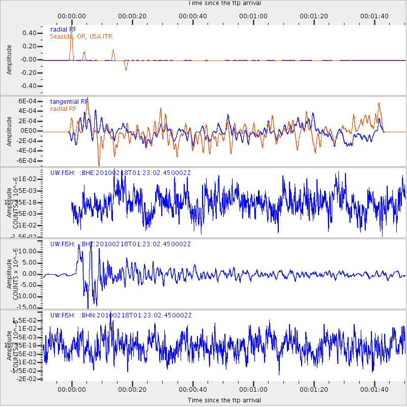
FISH Seaside, OR, USA - Earthquake Result Viewer
*The percent match for this event was below the threshold and hence no stack was calculated.
| Earthquake location: |
E. Russia-N.E. China Border Reg. |
| Earthquake latitude/longitude: |
42.6/130.7 |
| Earthquake time(UTC): |
2010/02/18 (049) 01:13:19 GMT |
| Earthquake Depth: |
578 km |
| Earthquake Magnitude: |
6.3 MB, 6.9 MW, 6.9 MW |
| Earthquake Catalog/Contributor: |
WHDF/NEIC |
|
| Network: |
UW Pacific Northwest Regional Seismic Network |
| Station: |
FISH Seaside, OR, USA |
| Lat/Lon: |
45.93 N/123.56 W |
| Elevation: |
325 m |
|
| Distance: |
69.9 deg |
| Az: |
45.658 deg |
| Baz: |
310.821 deg |
| Ray Param: |
$rayparam |
*The percent match for this event was below the threshold and hence was not used in the summary stack. |
|
| Radial Match: |
45.78416 % |
| Radial Bump: |
400 |
| Transverse Match: |
59.88871 % |
| Transverse Bump: |
400 |
| SOD ConfigId: |
306082 |
| Insert Time: |
2010-05-06 08:58:30.731 +0000 |
| GWidth: |
2.5 |
| Max Bumps: |
400 |
| Tol: |
0.001 |
|
Signal To Noise
| Channel | StoN | STA | LTA |
| UW:FISH: :BHZ:20100218T01:23:02.450002Z | 18.848408 | 6.0600614E-6 | 3.215158E-7 |
| UW:FISH: :BHN:20100218T01:23:02.450002Z | 0.8581855 | 5.07404E-9 | 5.9125203E-9 |
| UW:FISH: :BHE:20100218T01:23:02.450002Z | 0.8036866 | 3.7785632E-9 | 4.701538E-9 |
| Arrivals |
| Ps | |
| PpPs | |
| PsPs/PpSs | |


