You are here: Home > Network List > UW - Pacific Northwest Regional Seismic Network Stations List
> Station LEBA Lebam, WA, USA > Earthquake Result Viewer
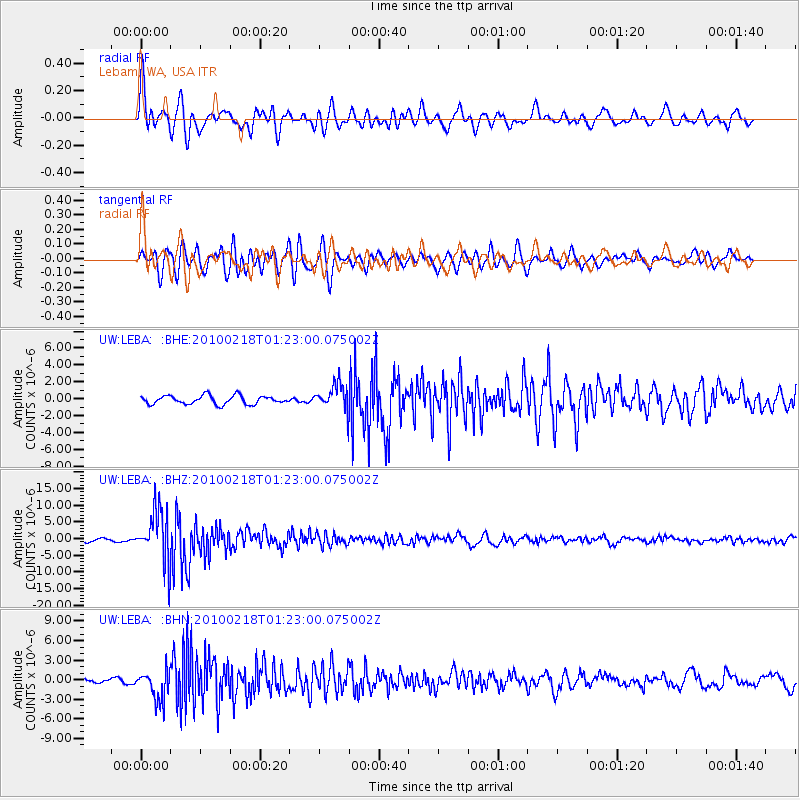
LEBA Lebam, WA, USA - Earthquake Result Viewer
*The percent match for this event was below the threshold and hence no stack was calculated.
| Earthquake location: |
E. Russia-N.E. China Border Reg. |
| Earthquake latitude/longitude: |
42.6/130.7 |
| Earthquake time(UTC): |
2010/02/18 (049) 01:13:19 GMT |
| Earthquake Depth: |
578 km |
| Earthquake Magnitude: |
6.3 MB, 6.9 MW, 6.9 MW |
| Earthquake Catalog/Contributor: |
WHDF/NEIC |
|
| Network: |
UW Pacific Northwest Regional Seismic Network |
| Station: |
LEBA Lebam, WA, USA |
| Lat/Lon: |
46.55 N/123.56 W |
| Elevation: |
73 m |
|
| Distance: |
69.5 deg |
| Az: |
45.162 deg |
| Baz: |
310.647 deg |
| Ray Param: |
$rayparam |
*The percent match for this event was below the threshold and hence was not used in the summary stack. |
|
| Radial Match: |
77.46954 % |
| Radial Bump: |
400 |
| Transverse Match: |
76.79577 % |
| Transverse Bump: |
400 |
| SOD ConfigId: |
306082 |
| Insert Time: |
2010-05-06 08:59:29.603 +0000 |
| GWidth: |
2.5 |
| Max Bumps: |
400 |
| Tol: |
0.001 |
|
Signal To Noise
| Channel | StoN | STA | LTA |
| UW:LEBA: :BHZ:20100218T01:23:00.075002Z | 16.351055 | 7.726556E-6 | 4.7254176E-7 |
| UW:LEBA: :BHN:20100218T01:23:00.075002Z | 5.8735785 | 2.259079E-6 | 3.8461715E-7 |
| UW:LEBA: :BHE:20100218T01:23:00.075002Z | 3.0134788 | 1.5121306E-6 | 5.0178903E-7 |
| Arrivals |
| Ps | |
| PpPs | |
| PsPs/PpSs | |


