SA17 XA.SA17 - Earthquake Result Viewer
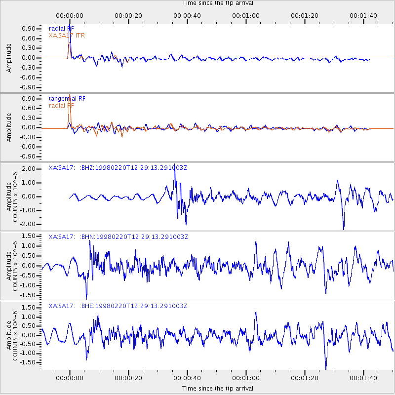
Earthquake location: Afghanistan-Tajikistan Bord Reg.
Earthquake latitude/longitude: 36.5/71.1
Earthquake time(UTC): 1998/02/20 (051) 12:18:06 GMT
Earthquake Depth: 236 km
Earthquake Magnitude: 5.8 MB, 5.7 MS, 6.4 UNKNOWN, 6.3 MW
Earthquake Catalog/Contributor: WHDF/NEIC
Network: XA Anatomy of an Archean Craton, South Africa
Station: SA17 XA.SA17
Lat/Lon: 28.93 S/23.23 E
Elevation: 1249 m
Distance: 79.1 deg
Az: 221.447 deg
Baz: 37.49 deg
Ray Param: 0.048584618
Estimated Moho Depth: 37.75 km
Estimated Crust Vp/Vs: 1.61
Assumed Crust Vp: 6.612 km/s
Estimated Crust Vs: 4.12 km/s
Estimated Crust Poisson's Ratio: 0.18
Radial Match: 83.11943 %
Radial Bump: 400
Transverse Match: 56.780373 %
Transverse Bump: 400
SOD ConfigId: 6273
Insert Time: 2010-02-26 18:04:30.077 +0000
GWidth: 2.5
Max Bumps: 400
Tol: 0.001

Signal To Noise

ChannelStoNSTALTA
XA:SA17: :BHN:19980220T12:29:13.291003Z3.18598943.6492338E-71.1454005E-7
XA:SA17: :BHE:19980220T12:29:13.291003Z1.92257863.6668825E-71.9072732E-7
XA:SA17: :BHZ:19980220T12:29:13.291003Z2.75643873.5505815E-71.2881046E-7
Arrivals
Ps3.6 SECOND
PpPs14 SECOND
PsPs/PpSs18 SECOND