You are here: Home > Network List > IU - Global Seismograph Network (GSN - IRIS/USGS) Stations List
> Station RSSD Black Hills, South Dakota, USA > Earthquake Result Viewer
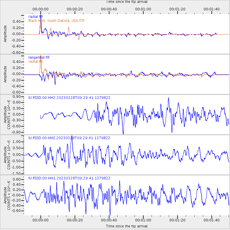
RSSD Black Hills, South Dakota, USA - Earthquake Result Viewer
*The percent match for this event was below the threshold and hence no stack was calculated.
| Earthquake location: |
Hokkaido, Japan Region |
| Earthquake latitude/longitude: |
41.1/142.8 |
| Earthquake time(UTC): |
2023/03/28 (087) 09:18:27 GMT |
| Earthquake Depth: |
31 km |
| Earthquake Magnitude: |
6.2 Mww |
| Earthquake Catalog/Contributor: |
NEIC PDE/us |
|
| Network: |
IU Global Seismograph Network (GSN - IRIS/USGS) |
| Station: |
RSSD Black Hills, South Dakota, USA |
| Lat/Lon: |
44.12 N/104.04 W |
| Elevation: |
2090 m |
|
| Distance: |
76.1 deg |
| Az: |
43.016 deg |
| Baz: |
314.327 deg |
| Ray Param: |
$rayparam |
*The percent match for this event was below the threshold and hence was not used in the summary stack. |
|
| Radial Match: |
71.8599 % |
| Radial Bump: |
400 |
| Transverse Match: |
56.309433 % |
| Transverse Bump: |
400 |
| SOD ConfigId: |
30536071 |
| Insert Time: |
2023-04-11 09:36:02.477 +0000 |
| GWidth: |
2.5 |
| Max Bumps: |
400 |
| Tol: |
0.001 |
|
Signal To Noise
| Channel | StoN | STA | LTA |
| IU:RSSD:00:HHZ:20230328T09:29:41.137982Z | 2.5282686 | 3.5100308E-7 | 1.388314E-7 |
| IU:RSSD:00:HH1:20230328T09:29:41.137982Z | 0.76397437 | 1.3666303E-7 | 1.7888432E-7 |
| IU:RSSD:00:HH2:20230328T09:29:41.137982Z | 2.138751 | 2.0583929E-7 | 9.624275E-8 |
| Arrivals |
| Ps | |
| PpPs | |
| PsPs/PpSs | |


