You are here: Home > Network List > US - United States National Seismic Network Stations List
> Station MNTX Cornudas Mountains, Texas, USA > Earthquake Result Viewer
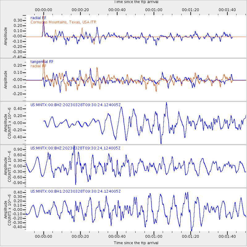
MNTX Cornudas Mountains, Texas, USA - Earthquake Result Viewer
*The percent match for this event was below the threshold and hence no stack was calculated.
| Earthquake location: |
Hokkaido, Japan Region |
| Earthquake latitude/longitude: |
41.1/142.8 |
| Earthquake time(UTC): |
2023/03/28 (087) 09:18:27 GMT |
| Earthquake Depth: |
31 km |
| Earthquake Magnitude: |
6.2 Mww |
| Earthquake Catalog/Contributor: |
NEIC PDE/us |
|
| Network: |
US United States National Seismic Network |
| Station: |
MNTX Cornudas Mountains, Texas, USA |
| Lat/Lon: |
31.70 N/105.38 W |
| Elevation: |
405 m |
|
| Distance: |
84.1 deg |
| Az: |
52.712 deg |
| Baz: |
315.179 deg |
| Ray Param: |
$rayparam |
*The percent match for this event was below the threshold and hence was not used in the summary stack. |
|
| Radial Match: |
73.37293 % |
| Radial Bump: |
400 |
| Transverse Match: |
71.19407 % |
| Transverse Bump: |
371 |
| SOD ConfigId: |
30536071 |
| Insert Time: |
2023-04-11 09:48:08.119 +0000 |
| GWidth: |
2.5 |
| Max Bumps: |
400 |
| Tol: |
0.001 |
|
Signal To Noise
| Channel | StoN | STA | LTA |
| US:MNTX:00:BHZ:20230328T09:30:24.124005Z | 2.2214794 | 4.2880143E-7 | 1.9302517E-7 |
| US:MNTX:00:BH1:20230328T09:30:24.124005Z | 0.85296535 | 6.463458E-8 | 7.577632E-8 |
| US:MNTX:00:BH2:20230328T09:30:24.124005Z | 2.2492552 | 1.6222835E-7 | 7.212537E-8 |
| Arrivals |
| Ps | |
| PpPs | |
| PsPs/PpSs | |


