You are here: Home > Network List > TA - USArray Transportable Network (new EarthScope stations) Stations List
> Station Z14A Wintersburg, AZ, USA > Earthquake Result Viewer
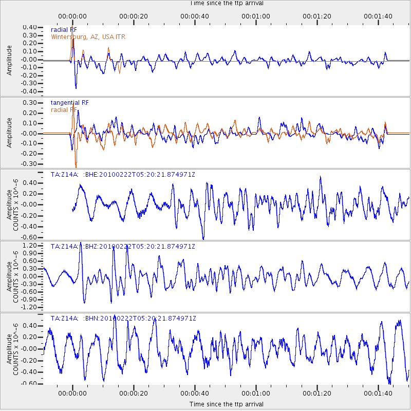
Z14A Wintersburg, AZ, USA - Earthquake Result Viewer
*The percent match for this event was below the threshold and hence no stack was calculated.
| Earthquake location: |
Tonga Islands |
| Earthquake latitude/longitude: |
-21.5/-173.8 |
| Earthquake time(UTC): |
2010/02/22 (053) 05:08:49 GMT |
| Earthquake Depth: |
33 km |
| Earthquake Magnitude: |
5.8 MB, 5.3 MS, 5.7 MW, 5.7 MW |
| Earthquake Catalog/Contributor: |
WHDF/NEIC |
|
| Network: |
TA USArray Transportable Network (new EarthScope stations) |
| Station: |
Z14A Wintersburg, AZ, USA |
| Lat/Lon: |
33.36 N/112.95 W |
| Elevation: |
298 m |
|
| Distance: |
79.6 deg |
| Az: |
47.983 deg |
| Baz: |
235.756 deg |
| Ray Param: |
$rayparam |
*The percent match for this event was below the threshold and hence was not used in the summary stack. |
|
| Radial Match: |
65.59722 % |
| Radial Bump: |
400 |
| Transverse Match: |
45.415928 % |
| Transverse Bump: |
400 |
| SOD ConfigId: |
307546 |
| Insert Time: |
2010-05-14 06:46:07.480 +0000 |
| GWidth: |
2.5 |
| Max Bumps: |
400 |
| Tol: |
0.001 |
|
Signal To Noise
| Channel | StoN | STA | LTA |
| TA:Z14A: :BHZ:20100222T05:20:21.874971Z | 3.1051147 | 5.9032675E-7 | 1.9011432E-7 |
| TA:Z14A: :BHN:20100222T05:20:21.874971Z | 1.801625 | 2.430716E-7 | 1.3491798E-7 |
| TA:Z14A: :BHE:20100222T05:20:21.874971Z | 1.1594901 | 1.8464257E-7 | 1.5924462E-7 |
| Arrivals |
| Ps | |
| PpPs | |
| PsPs/PpSs | |


