You are here: Home > Network List > TA - USArray Transportable Network (new EarthScope stations) Stations List
> Station R11A Troy Canyon, Currant, NV, USA > Earthquake Result Viewer
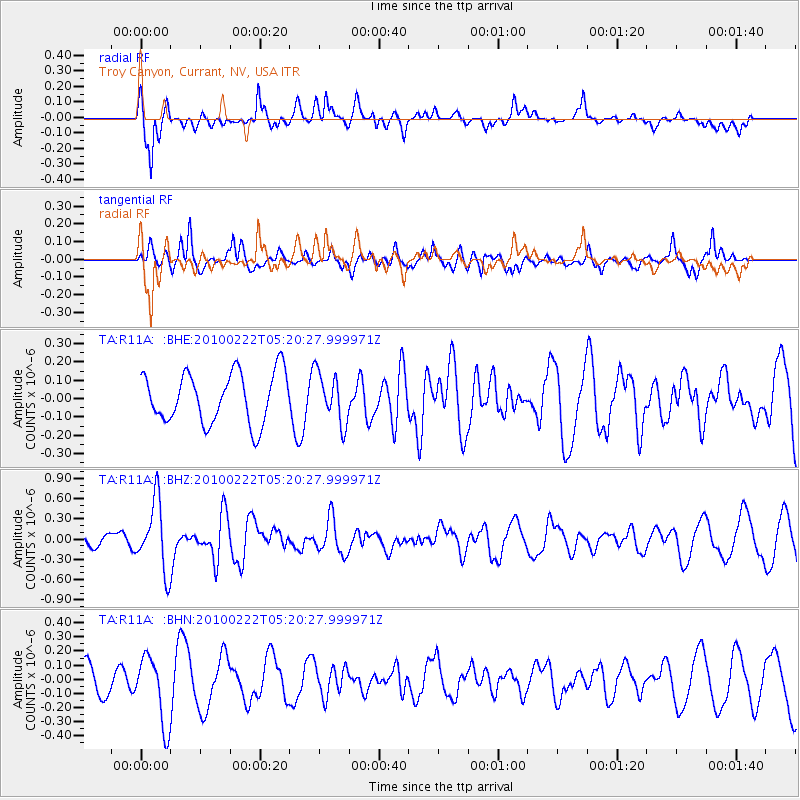
R11A Troy Canyon, Currant, NV, USA - Earthquake Result Viewer
*The percent match for this event was below the threshold and hence no stack was calculated.
| Earthquake location: |
Tonga Islands |
| Earthquake latitude/longitude: |
-21.5/-173.8 |
| Earthquake time(UTC): |
2010/02/22 (053) 05:08:49 GMT |
| Earthquake Depth: |
33 km |
| Earthquake Magnitude: |
5.8 MB, 5.3 MS, 5.7 MW, 5.7 MW |
| Earthquake Catalog/Contributor: |
WHDF/NEIC |
|
| Network: |
TA USArray Transportable Network (new EarthScope stations) |
| Station: |
R11A Troy Canyon, Currant, NV, USA |
| Lat/Lon: |
38.35 N/115.59 W |
| Elevation: |
1756 m |
|
| Distance: |
80.8 deg |
| Az: |
42.608 deg |
| Baz: |
233.298 deg |
| Ray Param: |
$rayparam |
*The percent match for this event was below the threshold and hence was not used in the summary stack. |
|
| Radial Match: |
77.07149 % |
| Radial Bump: |
400 |
| Transverse Match: |
60.497974 % |
| Transverse Bump: |
372 |
| SOD ConfigId: |
307546 |
| Insert Time: |
2010-05-14 06:46:22.321 +0000 |
| GWidth: |
2.5 |
| Max Bumps: |
400 |
| Tol: |
0.001 |
|
Signal To Noise
| Channel | StoN | STA | LTA |
| TA:R11A: :BHZ:20100222T05:20:27.999971Z | 6.685868 | 5.123E-7 | 7.66243E-8 |
| TA:R11A: :BHN:20100222T05:20:27.999971Z | 2.7082696 | 2.4202336E-7 | 8.9364576E-8 |
| TA:R11A: :BHE:20100222T05:20:27.999971Z | 1.0031874 | 1.372064E-7 | 1.3677045E-7 |
| Arrivals |
| Ps | |
| PpPs | |
| PsPs/PpSs | |


