You are here: Home > Network List > TA - USArray Transportable Network (new EarthScope stations) Stations List
> Station MSTX Muleshoe, TX, USA > Earthquake Result Viewer
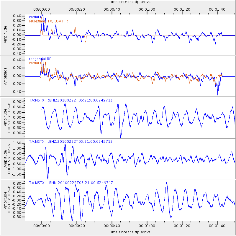
MSTX Muleshoe, TX, USA - Earthquake Result Viewer
*The percent match for this event was below the threshold and hence no stack was calculated.
| Earthquake location: |
Tonga Islands |
| Earthquake latitude/longitude: |
-21.5/-173.8 |
| Earthquake time(UTC): |
2010/02/22 (053) 05:08:49 GMT |
| Earthquake Depth: |
33 km |
| Earthquake Magnitude: |
5.8 MB, 5.3 MS, 5.7 MW, 5.7 MW |
| Earthquake Catalog/Contributor: |
WHDF/NEIC |
|
| Network: |
TA USArray Transportable Network (new EarthScope stations) |
| Station: |
MSTX Muleshoe, TX, USA |
| Lat/Lon: |
33.97 N/102.77 W |
| Elevation: |
1167 m |
|
| Distance: |
87.2 deg |
| Az: |
51.884 deg |
| Baz: |
241.829 deg |
| Ray Param: |
$rayparam |
*The percent match for this event was below the threshold and hence was not used in the summary stack. |
|
| Radial Match: |
70.98675 % |
| Radial Bump: |
367 |
| Transverse Match: |
48.013767 % |
| Transverse Bump: |
395 |
| SOD ConfigId: |
307546 |
| Insert Time: |
2010-05-14 06:48:04.631 +0000 |
| GWidth: |
2.5 |
| Max Bumps: |
400 |
| Tol: |
0.001 |
|
Signal To Noise
| Channel | StoN | STA | LTA |
| TA:MSTX: :BHZ:20100222T05:21:00.624971Z | 2.0402002 | 7.8763696E-7 | 3.8605864E-7 |
| TA:MSTX: :BHN:20100222T05:21:00.624971Z | 0.540347 | 1.4943943E-7 | 2.76562E-7 |
| TA:MSTX: :BHE:20100222T05:21:00.624971Z | 1.0549525 | 4.4126392E-7 | 4.1827846E-7 |
| Arrivals |
| Ps | |
| PpPs | |
| PsPs/PpSs | |


