You are here: Home > Network List > TA - USArray Transportable Network (new EarthScope stations) Stations List
> Station X26A CR and CF Franklin Farms, Melrose, NM, USA > Earthquake Result Viewer
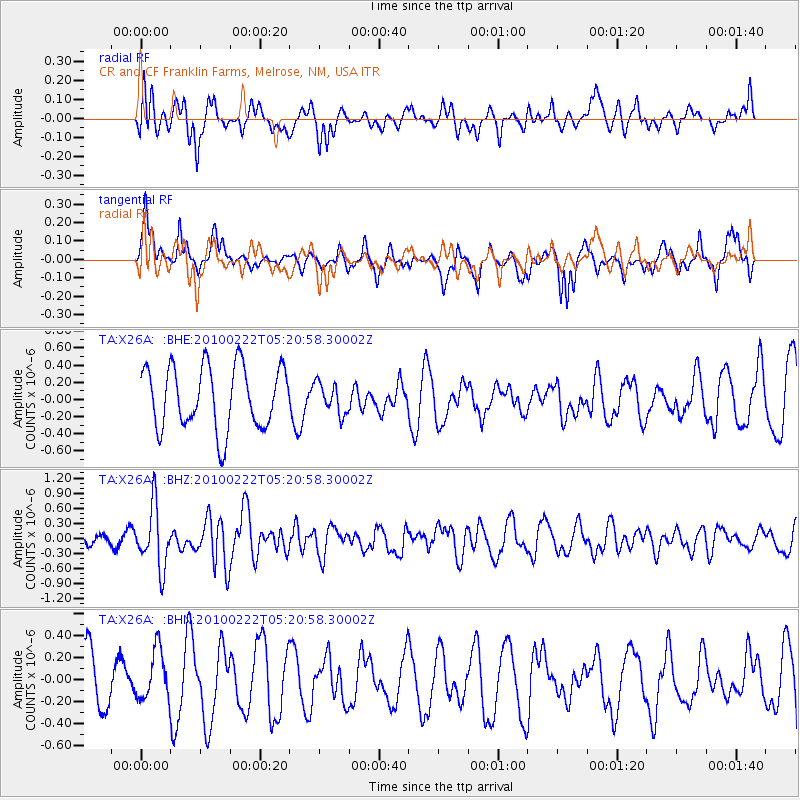
X26A CR and CF Franklin Farms, Melrose, NM, USA - Earthquake Result Viewer
*The percent match for this event was below the threshold and hence no stack was calculated.
| Earthquake location: |
Tonga Islands |
| Earthquake latitude/longitude: |
-21.5/-173.8 |
| Earthquake time(UTC): |
2010/02/22 (053) 05:08:49 GMT |
| Earthquake Depth: |
33 km |
| Earthquake Magnitude: |
5.8 MB, 5.3 MS, 5.7 MW, 5.7 MW |
| Earthquake Catalog/Contributor: |
WHDF/NEIC |
|
| Network: |
TA USArray Transportable Network (new EarthScope stations) |
| Station: |
X26A CR and CF Franklin Farms, Melrose, NM, USA |
| Lat/Lon: |
34.55 N/103.81 W |
| Elevation: |
1393 m |
|
| Distance: |
86.7 deg |
| Az: |
50.963 deg |
| Baz: |
241.199 deg |
| Ray Param: |
$rayparam |
*The percent match for this event was below the threshold and hence was not used in the summary stack. |
|
| Radial Match: |
62.30104 % |
| Radial Bump: |
400 |
| Transverse Match: |
55.905727 % |
| Transverse Bump: |
341 |
| SOD ConfigId: |
307546 |
| Insert Time: |
2010-05-14 06:48:32.674 +0000 |
| GWidth: |
2.5 |
| Max Bumps: |
400 |
| Tol: |
0.001 |
|
Signal To Noise
| Channel | StoN | STA | LTA |
| TA:X26A: :BHZ:20100222T05:20:58.30002Z | 2.2083802 | 6.1048746E-7 | 2.7644128E-7 |
| TA:X26A: :BHN:20100222T05:20:58.30002Z | 0.8252684 | 2.2802885E-7 | 2.7630873E-7 |
| TA:X26A: :BHE:20100222T05:20:58.30002Z | 0.49589103 | 1.8000642E-7 | 3.6299593E-7 |
| Arrivals |
| Ps | |
| PpPs | |
| PsPs/PpSs | |


