You are here: Home > Network List > AV - Alaska Volcano Observatory Stations List
> Station MAPS Pakushin Southeast, Makushin Volcano, Alaska > Earthquake Result Viewer
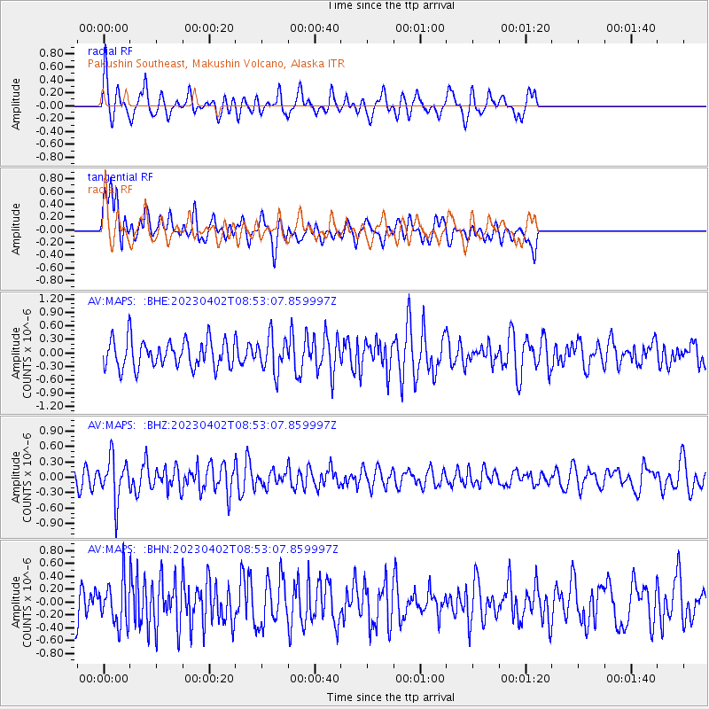
MAPS Pakushin Southeast, Makushin Volcano, Alaska - Earthquake Result Viewer
*The percent match for this event was below the threshold and hence no stack was calculated.
| Earthquake location: |
Flores Sea |
| Earthquake latitude/longitude: |
-7.8/118.7 |
| Earthquake time(UTC): |
2023/04/02 (092) 08:40:54 GMT |
| Earthquake Depth: |
19 km |
| Earthquake Magnitude: |
5.5 Mww |
| Earthquake Catalog/Contributor: |
NEIC PDE/us |
|
| Network: |
AV Alaska Volcano Observatory |
| Station: |
MAPS Pakushin Southeast, Makushin Volcano, Alaska |
| Lat/Lon: |
53.81 N/166.94 W |
| Elevation: |
333 m |
|
| Distance: |
87.1 deg |
| Az: |
34.876 deg |
| Baz: |
252.816 deg |
| Ray Param: |
$rayparam |
*The percent match for this event was below the threshold and hence was not used in the summary stack. |
|
| Radial Match: |
58.91615 % |
| Radial Bump: |
400 |
| Transverse Match: |
63.70614 % |
| Transverse Bump: |
400 |
| SOD ConfigId: |
30536071 |
| Insert Time: |
2023-04-16 08:45:03.454 +0000 |
| GWidth: |
2.5 |
| Max Bumps: |
400 |
| Tol: |
0.001 |
|
Signal To Noise
| Channel | StoN | STA | LTA |
| AV:MAPS: :BHZ:20230402T08:53:07.859997Z | 2.8960867 | 4.1373127E-7 | 1.4285872E-7 |
| AV:MAPS: :BHN:20230402T08:53:07.859997Z | 1.1649027 | 3.5030723E-7 | 3.0071803E-7 |
| AV:MAPS: :BHE:20230402T08:53:07.859997Z | 1.2895602 | 3.9867803E-7 | 3.091581E-7 |
| Arrivals |
| Ps | |
| PpPs | |
| PsPs/PpSs | |


