You are here: Home > Network List > IU - Global Seismograph Network (GSN - IRIS/USGS) Stations List
> Station MAKZ Makanchi, Kazakhstan > Earthquake Result Viewer
MAKZ Makanchi, Kazakhstan - Earthquake Result Viewer

| Earthquake location: |
New Britain Region, P.N.G. |
| Earthquake latitude/longitude: |
-5.9/151.4 |
| Earthquake time(UTC): |
2018/10/10 (283) 20:48:20 GMT |
| Earthquake Depth: |
33 km |
| Earthquake Magnitude: |
7.3 Mi |
| Earthquake Catalog/Contributor: |
NEIC PDE/at |
|
| Network: |
IU Global Seismograph Network (GSN - IRIS/USGS) |
| Station: |
MAKZ Makanchi, Kazakhstan |
| Lat/Lon: |
46.81 N/81.98 E |
| Elevation: |
600 m |
|
| Distance: |
80.4 deg |
| Az: |
319.3 deg |
| Baz: |
109.196 deg |
| Ray Param: |
0.048224952 |
| Estimated Moho Depth: |
48.0 km |
| Estimated Crust Vp/Vs: |
1.81 |
| Assumed Crust Vp: |
6.571 km/s |
| Estimated Crust Vs: |
3.625 km/s |
| Estimated Crust Poisson's Ratio: |
0.28 |
|
| Radial Match: |
98.273674 % |
| Radial Bump: |
263 |
| Transverse Match: |
95.130165 % |
| Transverse Bump: |
400 |
| SOD ConfigId: |
3045211 |
| Insert Time: |
2018-10-24 20:56:44.035 +0000 |
| GWidth: |
2.5 |
| Max Bumps: |
400 |
| Tol: |
0.001 |
|
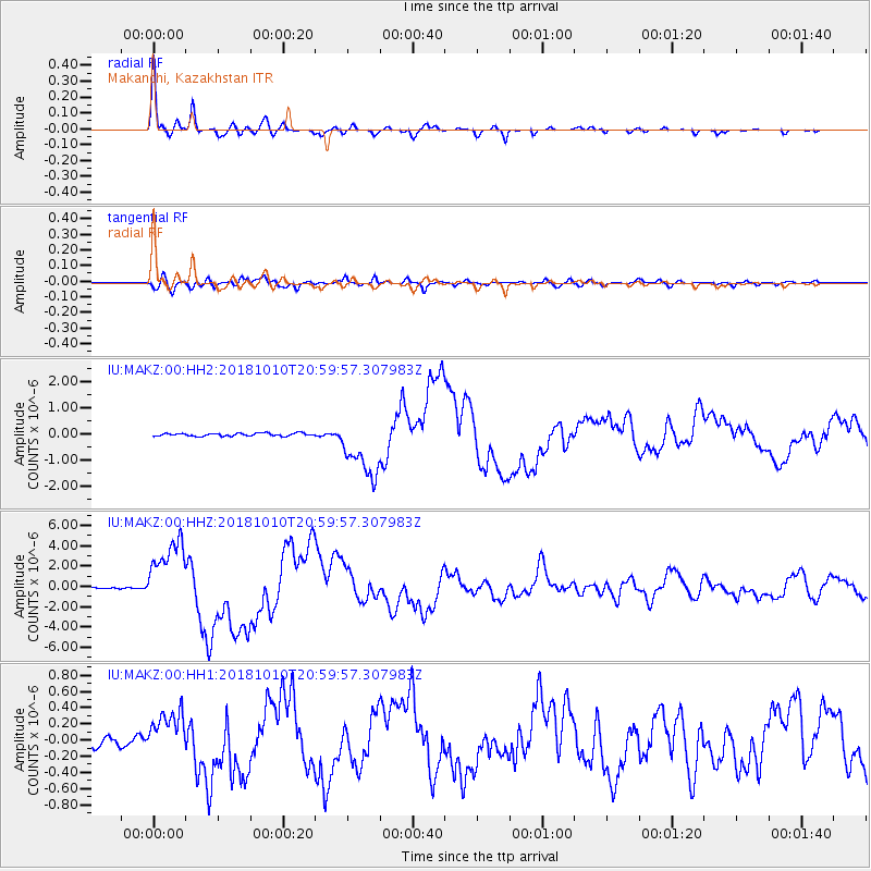
Signal To Noise
| Channel | StoN | STA | LTA |
| IU:MAKZ:00:HHZ:20181010T20:59:57.307983Z | 31.722828 | 3.4213926E-6 | 1.078527E-7 |
| IU:MAKZ:00:HH1:20181010T20:59:57.307983Z | 5.7322206 | 2.781153E-7 | 4.8517894E-8 |
| IU:MAKZ:00:HH2:20181010T20:59:57.307983Z | 21.111748 | 1.1964938E-6 | 5.6674317E-8 |
| Arrivals |
| Ps | 6.1 SECOND |
| PpPs | 20 SECOND |
| PsPs/PpSs | 26 SECOND |


