You are here: Home > Network List > TA - USArray Transportable Network (new EarthScope stations) Stations List
> Station 430A Baggett Ranch, Ozona, TX, USA > Earthquake Result Viewer
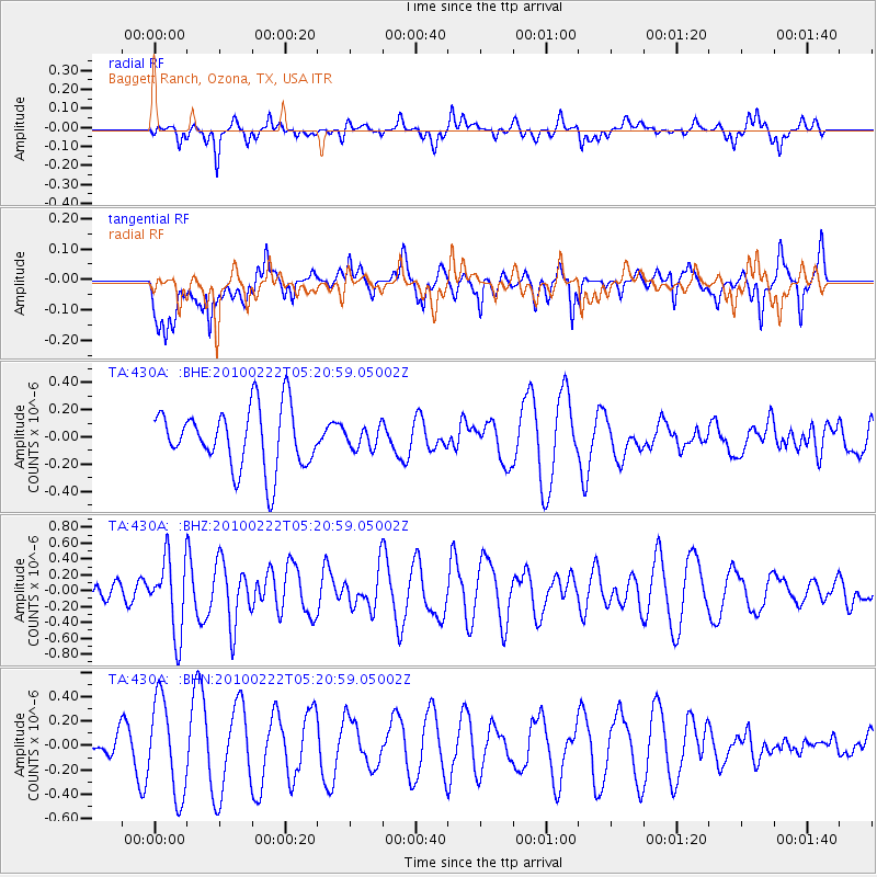
430A Baggett Ranch, Ozona, TX, USA - Earthquake Result Viewer
*The percent match for this event was below the threshold and hence no stack was calculated.
| Earthquake location: |
Tonga Islands |
| Earthquake latitude/longitude: |
-21.5/-173.8 |
| Earthquake time(UTC): |
2010/02/22 (053) 05:08:49 GMT |
| Earthquake Depth: |
33 km |
| Earthquake Magnitude: |
5.8 MB, 5.3 MS, 5.7 MW, 5.7 MW |
| Earthquake Catalog/Contributor: |
WHDF/NEIC |
|
| Network: |
TA USArray Transportable Network (new EarthScope stations) |
| Station: |
430A Baggett Ranch, Ozona, TX, USA |
| Lat/Lon: |
30.79 N/101.24 W |
| Elevation: |
768 m |
|
| Distance: |
86.9 deg |
| Az: |
55.303 deg |
| Baz: |
242.826 deg |
| Ray Param: |
$rayparam |
*The percent match for this event was below the threshold and hence was not used in the summary stack. |
|
| Radial Match: |
46.75197 % |
| Radial Bump: |
340 |
| Transverse Match: |
31.686901 % |
| Transverse Bump: |
395 |
| SOD ConfigId: |
307546 |
| Insert Time: |
2010-05-14 06:53:44.243 +0000 |
| GWidth: |
2.5 |
| Max Bumps: |
400 |
| Tol: |
0.001 |
|
Signal To Noise
| Channel | StoN | STA | LTA |
| TA:430A: :BHZ:20100222T05:20:59.05002Z | 1.7884194 | 4.7097552E-7 | 2.6334735E-7 |
| TA:430A: :BHN:20100222T05:20:59.05002Z | 2.2157364 | 3.8605828E-7 | 1.7423476E-7 |
| TA:430A: :BHE:20100222T05:20:59.05002Z | 0.34318522 | 7.630054E-8 | 2.2233048E-7 |
| Arrivals |
| Ps | |
| PpPs | |
| PsPs/PpSs | |


