You are here: Home > Network List > TA - USArray Transportable Network (new EarthScope stations) Stations List
> Station 332A Millersview, TX, USA > Earthquake Result Viewer
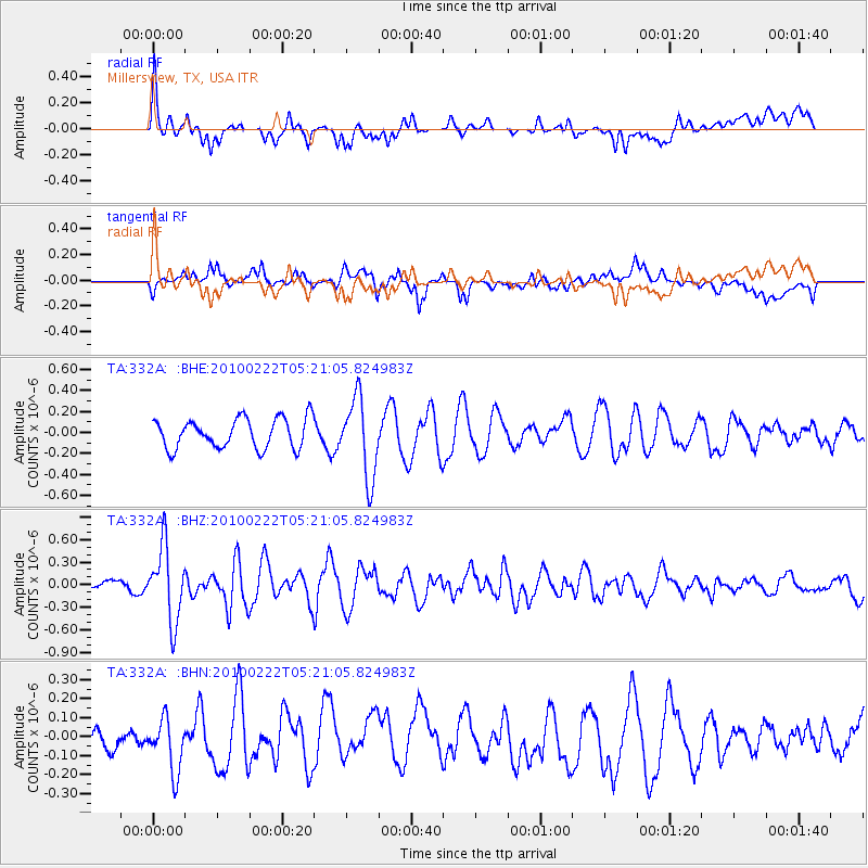
332A Millersview, TX, USA - Earthquake Result Viewer
*The percent match for this event was below the threshold and hence no stack was calculated.
| Earthquake location: |
Tonga Islands |
| Earthquake latitude/longitude: |
-21.5/-173.8 |
| Earthquake time(UTC): |
2010/02/22 (053) 05:08:49 GMT |
| Earthquake Depth: |
33 km |
| Earthquake Magnitude: |
5.8 MB, 5.3 MS, 5.7 MW, 5.7 MW |
| Earthquake Catalog/Contributor: |
WHDF/NEIC |
|
| Network: |
TA USArray Transportable Network (new EarthScope stations) |
| Station: |
332A Millersview, TX, USA |
| Lat/Lon: |
31.38 N/99.74 W |
| Elevation: |
513 m |
|
| Distance: |
88.3 deg |
| Az: |
55.35 deg |
| Baz: |
243.595 deg |
| Ray Param: |
$rayparam |
*The percent match for this event was below the threshold and hence was not used in the summary stack. |
|
| Radial Match: |
63.51141 % |
| Radial Bump: |
400 |
| Transverse Match: |
50.4346 % |
| Transverse Bump: |
400 |
| SOD ConfigId: |
307546 |
| Insert Time: |
2010-05-14 06:54:54.001 +0000 |
| GWidth: |
2.5 |
| Max Bumps: |
400 |
| Tol: |
0.001 |
|
Signal To Noise
| Channel | StoN | STA | LTA |
| TA:332A: :BHZ:20100222T05:21:05.824983Z | 4.2062106 | 4.9229675E-7 | 1.1704044E-7 |
| TA:332A: :BHN:20100222T05:21:05.824983Z | 1.1549002 | 1.7191138E-7 | 1.4885389E-7 |
| TA:332A: :BHE:20100222T05:21:05.824983Z | 2.6706238 | 3.7622098E-7 | 1.4087382E-7 |
| Arrivals |
| Ps | |
| PpPs | |
| PsPs/PpSs | |


