You are here: Home > Network List > TA - USArray Transportable Network (new EarthScope stations) Stations List
> Station 833A Chaparral WMA, Artesia Wells, TX, USA > Earthquake Result Viewer
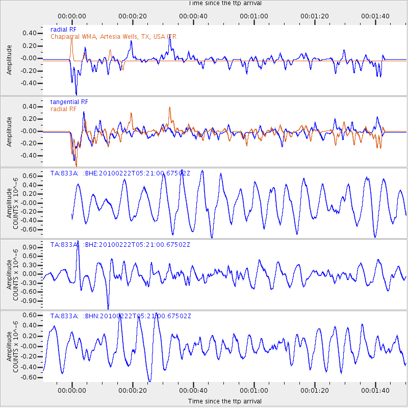
833A Chaparral WMA, Artesia Wells, TX, USA - Earthquake Result Viewer
*The percent match for this event was below the threshold and hence no stack was calculated.
| Earthquake location: |
Tonga Islands |
| Earthquake latitude/longitude: |
-21.5/-173.8 |
| Earthquake time(UTC): |
2010/02/22 (053) 05:08:49 GMT |
| Earthquake Depth: |
33 km |
| Earthquake Magnitude: |
5.8 MB, 5.3 MS, 5.7 MW, 5.7 MW |
| Earthquake Catalog/Contributor: |
WHDF/NEIC |
|
| Network: |
TA USArray Transportable Network (new EarthScope stations) |
| Station: |
833A Chaparral WMA, Artesia Wells, TX, USA |
| Lat/Lon: |
28.32 N/99.39 W |
| Elevation: |
171 m |
|
| Distance: |
87.2 deg |
| Az: |
58.221 deg |
| Baz: |
243.882 deg |
| Ray Param: |
$rayparam |
*The percent match for this event was below the threshold and hence was not used in the summary stack. |
|
| Radial Match: |
57.276764 % |
| Radial Bump: |
329 |
| Transverse Match: |
65.20003 % |
| Transverse Bump: |
379 |
| SOD ConfigId: |
307546 |
| Insert Time: |
2010-05-14 07:00:23.368 +0000 |
| GWidth: |
2.5 |
| Max Bumps: |
400 |
| Tol: |
0.001 |
|
Signal To Noise
| Channel | StoN | STA | LTA |
| TA:833A: :BHZ:20100222T05:21:00.67502Z | 3.6603727 | 4.3542468E-7 | 1.1895638E-7 |
| TA:833A: :BHN:20100222T05:21:00.67502Z | 0.5375258 | 1.6006939E-7 | 2.9778923E-7 |
| TA:833A: :BHE:20100222T05:21:00.67502Z | 1.7203438 | 4.3371293E-7 | 2.5210826E-7 |
| Arrivals |
| Ps | |
| PpPs | |
| PsPs/PpSs | |


