You are here: Home > Network List > US - United States National Seismic Network Stations List
> Station DGMT Dagmar, Montana, USA > Earthquake Result Viewer
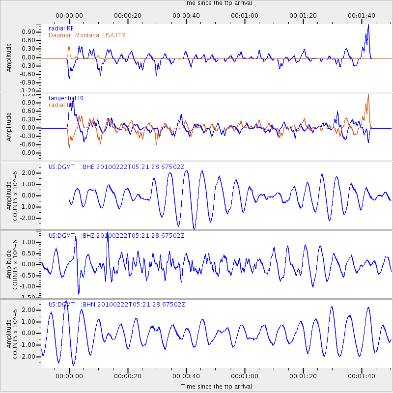
DGMT Dagmar, Montana, USA - Earthquake Result Viewer
*The percent match for this event was below the threshold and hence no stack was calculated.
| Earthquake location: |
Tonga Islands |
| Earthquake latitude/longitude: |
-21.5/-173.8 |
| Earthquake time(UTC): |
2010/02/22 (053) 05:08:49 GMT |
| Earthquake Depth: |
33 km |
| Earthquake Magnitude: |
5.8 MB, 5.3 MS, 5.7 MW, 5.7 MW |
| Earthquake Catalog/Contributor: |
WHDF/NEIC |
|
| Network: |
US United States National Seismic Network |
| Station: |
DGMT Dagmar, Montana, USA |
| Lat/Lon: |
48.47 N/104.20 W |
| Elevation: |
0.0 m |
|
| Distance: |
93.2 deg |
| Az: |
38.658 deg |
| Baz: |
240.933 deg |
| Ray Param: |
$rayparam |
*The percent match for this event was below the threshold and hence was not used in the summary stack. |
|
| Radial Match: |
59.490818 % |
| Radial Bump: |
317 |
| Transverse Match: |
58.53092 % |
| Transverse Bump: |
382 |
| SOD ConfigId: |
307546 |
| Insert Time: |
2010-05-14 07:03:37.801 +0000 |
| GWidth: |
2.5 |
| Max Bumps: |
400 |
| Tol: |
0.001 |
|
Signal To Noise
| Channel | StoN | STA | LTA |
| US:DGMT: :BHZ:20100222T05:21:28.67502Z | 2.8237271 | 6.1567386E-7 | 2.1803591E-7 |
| US:DGMT: :BHN:20100222T05:21:28.67502Z | 1.6849822 | 1.8391165E-6 | 1.0914754E-6 |
| US:DGMT: :BHE:20100222T05:21:28.67502Z | 2.47189 | 1.4081886E-6 | 5.6968094E-7 |
| Arrivals |
| Ps | |
| PpPs | |
| PsPs/PpSs | |


