You are here: Home > Network List > US - United States National Seismic Network Stations List
> Station MSO Missoula, Montana, USA > Earthquake Result Viewer
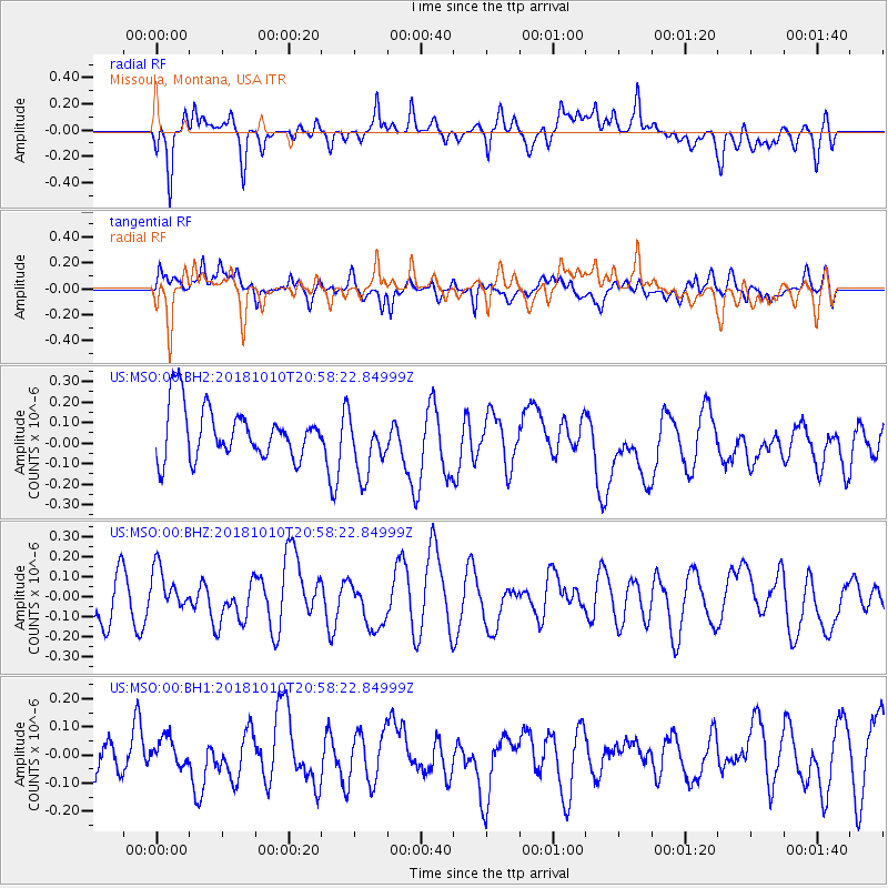
MSO Missoula, Montana, USA - Earthquake Result Viewer
*The percent match for this event was below the threshold and hence no stack was calculated.
| Earthquake location: |
New Britain Region, P.N.G. |
| Earthquake latitude/longitude: |
-5.8/151.3 |
| Earthquake time(UTC): |
2018/10/10 (283) 20:45:26 GMT |
| Earthquake Depth: |
52 km |
| Earthquake Magnitude: |
5.9 mb |
| Earthquake Catalog/Contributor: |
NEIC PDE/us |
|
| Network: |
US United States National Seismic Network |
| Station: |
MSO Missoula, Montana, USA |
| Lat/Lon: |
46.83 N/113.94 W |
| Elevation: |
1264 m |
|
| Distance: |
97.4 deg |
| Az: |
43.633 deg |
| Baz: |
269.482 deg |
| Ray Param: |
$rayparam |
*The percent match for this event was below the threshold and hence was not used in the summary stack. |
|
| Radial Match: |
58.312893 % |
| Radial Bump: |
400 |
| Transverse Match: |
55.759125 % |
| Transverse Bump: |
400 |
| SOD ConfigId: |
3045211 |
| Insert Time: |
2018-10-24 21:01:18.959 +0000 |
| GWidth: |
2.5 |
| Max Bumps: |
400 |
| Tol: |
0.001 |
|
Signal To Noise
| Channel | StoN | STA | LTA |
| US:MSO:00:BHZ:20181010T20:58:22.84999Z | 1.0012891 | 1.0880705E-7 | 1.0866697E-7 |
| US:MSO:00:BH1:20181010T20:58:22.84999Z | 0.52703345 | 5.0104283E-8 | 9.506851E-8 |
| US:MSO:00:BH2:20181010T20:58:22.84999Z | 1.2168856 | 1.5179327E-7 | 1.2473915E-7 |
| Arrivals |
| Ps | |
| PpPs | |
| PsPs/PpSs | |


