You are here: Home > Network List > CI - Caltech Regional Seismic Network Stations List
> Station MUR Murrieta > Earthquake Result Viewer
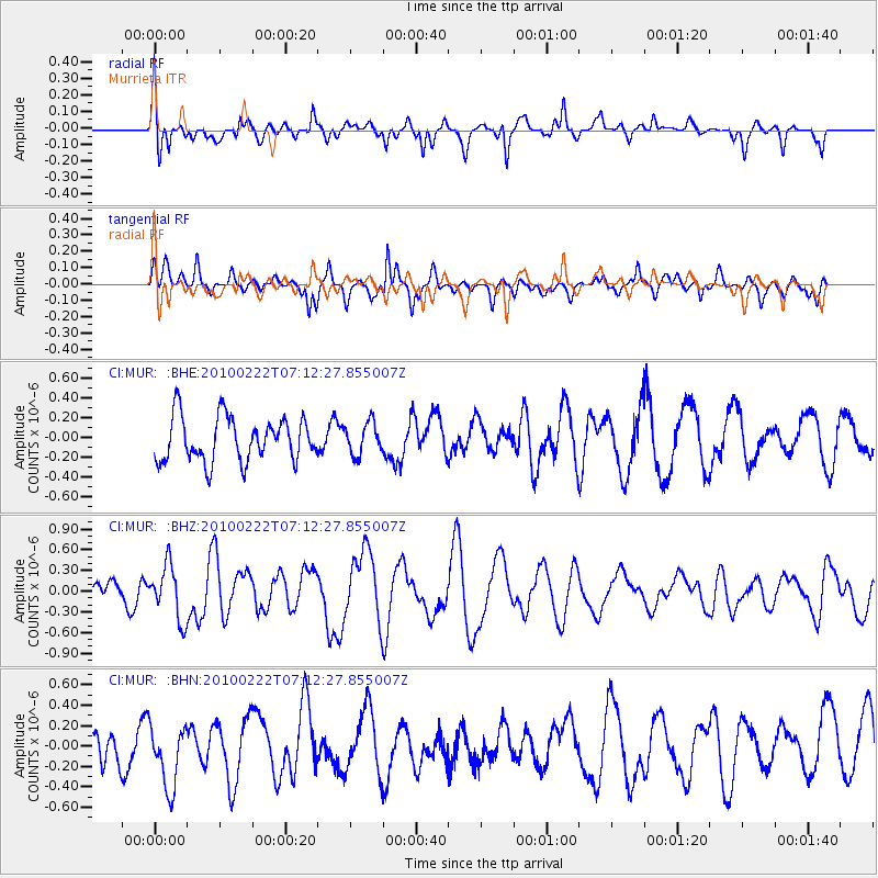
MUR Murrieta - Earthquake Result Viewer
*The percent match for this event was below the threshold and hence no stack was calculated.
| Earthquake location: |
South Of Fiji Islands |
| Earthquake latitude/longitude: |
-23.6/-176.0 |
| Earthquake time(UTC): |
2010/02/22 (053) 07:00:52 GMT |
| Earthquake Depth: |
25 km |
| Earthquake Magnitude: |
5.5 MB, 5.8 MS, 6.0 MW, 5.9 MW |
| Earthquake Catalog/Contributor: |
WHDF/NEIC |
|
| Network: |
CI Caltech Regional Seismic Network |
| Station: |
MUR Murrieta |
| Lat/Lon: |
33.60 N/117.20 W |
| Elevation: |
562 m |
|
| Distance: |
79.8 deg |
| Az: |
46.52 deg |
| Baz: |
232.874 deg |
| Ray Param: |
$rayparam |
*The percent match for this event was below the threshold and hence was not used in the summary stack. |
|
| Radial Match: |
66.398224 % |
| Radial Bump: |
358 |
| Transverse Match: |
63.751778 % |
| Transverse Bump: |
400 |
| SOD ConfigId: |
307546 |
| Insert Time: |
2010-05-14 07:15:27.192 +0000 |
| GWidth: |
2.5 |
| Max Bumps: |
400 |
| Tol: |
0.001 |
|
Signal To Noise
| Channel | StoN | STA | LTA |
| CI:MUR: :BHZ:20100222T07:12:27.855007Z | 1.53934 | 3.886456E-7 | 2.5247547E-7 |
| CI:MUR: :BHN:20100222T07:12:27.855007Z | 1.8250278 | 3.239997E-7 | 1.7753138E-7 |
| CI:MUR: :BHE:20100222T07:12:27.855007Z | 0.721426 | 1.59818E-7 | 2.2153068E-7 |
| Arrivals |
| Ps | |
| PpPs | |
| PsPs/PpSs | |


