You are here: Home > Network List > US - United States National Seismic Network Stations List
> Station HLID Hailey, Idaho, USA > Earthquake Result Viewer
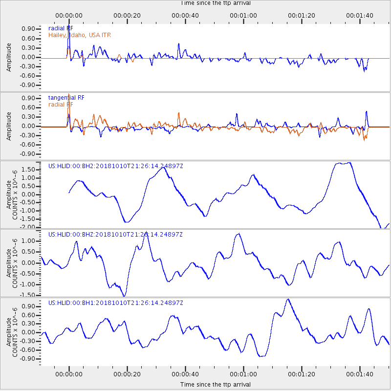
HLID Hailey, Idaho, USA - Earthquake Result Viewer
*The percent match for this event was below the threshold and hence no stack was calculated.
| Earthquake location: |
New Britain Region, P.N.G. |
| Earthquake latitude/longitude: |
-5.9/151.1 |
| Earthquake time(UTC): |
2018/10/10 (283) 21:13:16 GMT |
| Earthquake Depth: |
37 km |
| Earthquake Magnitude: |
5.9 Mww |
| Earthquake Catalog/Contributor: |
NEIC PDE/us |
|
| Network: |
US United States National Seismic Network |
| Station: |
HLID Hailey, Idaho, USA |
| Lat/Lon: |
43.56 N/114.41 W |
| Elevation: |
1772 m |
|
| Distance: |
97.3 deg |
| Az: |
46.939 deg |
| Baz: |
268.747 deg |
| Ray Param: |
$rayparam |
*The percent match for this event was below the threshold and hence was not used in the summary stack. |
|
| Radial Match: |
77.42642 % |
| Radial Bump: |
400 |
| Transverse Match: |
51.700943 % |
| Transverse Bump: |
400 |
| SOD ConfigId: |
3045211 |
| Insert Time: |
2018-10-24 21:28:58.351 +0000 |
| GWidth: |
2.5 |
| Max Bumps: |
400 |
| Tol: |
0.001 |
|
Signal To Noise
| Channel | StoN | STA | LTA |
| US:HLID:00:BHZ:20181010T21:26:14.24897Z | 2.411616 | 5.779202E-7 | 2.3964023E-7 |
| US:HLID:00:BH1:20181010T21:26:14.24897Z | 0.19079894 | 1.5431286E-7 | 8.087721E-7 |
| US:HLID:00:BH2:20181010T21:26:14.24897Z | 2.1342237 | 1.6446132E-6 | 7.705909E-7 |
| Arrivals |
| Ps | |
| PpPs | |
| PsPs/PpSs | |


