You are here: Home > Network List > TA - USArray Transportable Network (new EarthScope stations) Stations List
> Station V26A Tequesquite Ranch, Mosquero, NM, USA > Earthquake Result Viewer
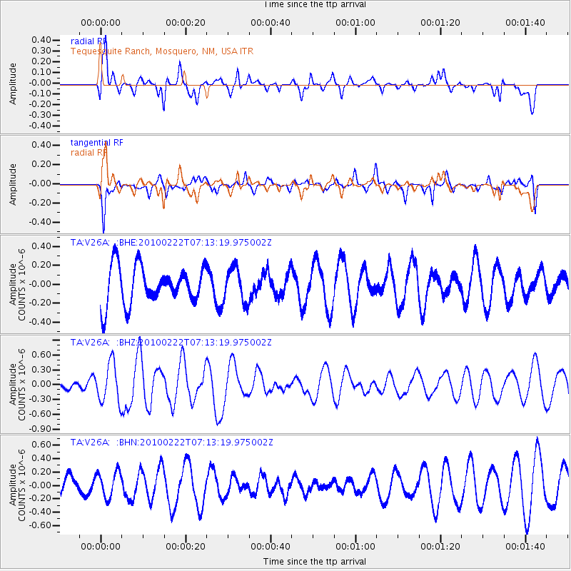
V26A Tequesquite Ranch, Mosquero, NM, USA - Earthquake Result Viewer
*The percent match for this event was below the threshold and hence no stack was calculated.
| Earthquake location: |
South Of Fiji Islands |
| Earthquake latitude/longitude: |
-23.6/-176.0 |
| Earthquake time(UTC): |
2010/02/22 (053) 07:00:52 GMT |
| Earthquake Depth: |
25 km |
| Earthquake Magnitude: |
5.5 MB, 5.8 MS, 6.0 MW, 5.9 MW |
| Earthquake Catalog/Contributor: |
WHDF/NEIC |
|
| Network: |
TA USArray Transportable Network (new EarthScope stations) |
| Station: |
V26A Tequesquite Ranch, Mosquero, NM, USA |
| Lat/Lon: |
35.80 N/103.79 W |
| Elevation: |
1362 m |
|
| Distance: |
90.3 deg |
| Az: |
50.739 deg |
| Baz: |
240.863 deg |
| Ray Param: |
$rayparam |
*The percent match for this event was below the threshold and hence was not used in the summary stack. |
|
| Radial Match: |
70.33072 % |
| Radial Bump: |
400 |
| Transverse Match: |
71.600914 % |
| Transverse Bump: |
400 |
| SOD ConfigId: |
307546 |
| Insert Time: |
2010-05-14 07:19:12.864 +0000 |
| GWidth: |
2.5 |
| Max Bumps: |
400 |
| Tol: |
0.001 |
|
Signal To Noise
| Channel | StoN | STA | LTA |
| TA:V26A: :BHZ:20100222T07:13:19.975002Z | 3.7443318 | 4.0622317E-7 | 1.0849016E-7 |
| TA:V26A: :BHN:20100222T07:13:19.975002Z | 1.265328 | 1.9438261E-7 | 1.536223E-7 |
| TA:V26A: :BHE:20100222T07:13:19.975002Z | 0.8997972 | 1.7860297E-7 | 1.9849247E-7 |
| Arrivals |
| Ps | |
| PpPs | |
| PsPs/PpSs | |


