You are here: Home > Network List > TA - USArray Transportable Network (new EarthScope stations) Stations List
> Station J22A Midwest, WY, USA > Earthquake Result Viewer
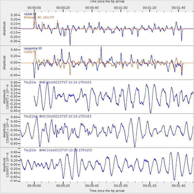
J22A Midwest, WY, USA - Earthquake Result Viewer
*The percent match for this event was below the threshold and hence no stack was calculated.
| Earthquake location: |
South Of Fiji Islands |
| Earthquake latitude/longitude: |
-23.6/-176.0 |
| Earthquake time(UTC): |
2010/02/22 (053) 07:00:52 GMT |
| Earthquake Depth: |
25 km |
| Earthquake Magnitude: |
5.5 MB, 5.8 MS, 6.0 MW, 5.9 MW |
| Earthquake Catalog/Contributor: |
WHDF/NEIC |
|
| Network: |
TA USArray Transportable Network (new EarthScope stations) |
| Station: |
J22A Midwest, WY, USA |
| Lat/Lon: |
43.41 N/106.48 W |
| Elevation: |
1587 m |
|
| Distance: |
92.3 deg |
| Az: |
43.108 deg |
| Baz: |
239.319 deg |
| Ray Param: |
$rayparam |
*The percent match for this event was below the threshold and hence was not used in the summary stack. |
|
| Radial Match: |
70.50777 % |
| Radial Bump: |
399 |
| Transverse Match: |
71.57267 % |
| Transverse Bump: |
359 |
| SOD ConfigId: |
307546 |
| Insert Time: |
2010-05-14 07:19:49.682 +0000 |
| GWidth: |
2.5 |
| Max Bumps: |
400 |
| Tol: |
0.001 |
|
Signal To Noise
| Channel | StoN | STA | LTA |
| TA:J22A: :BHZ:20100222T07:13:29.175015Z | 2.9585402 | 4.363001E-7 | 1.4747141E-7 |
| TA:J22A: :BHN:20100222T07:13:29.175015Z | 0.331452 | 7.501683E-8 | 2.2632788E-7 |
| TA:J22A: :BHE:20100222T07:13:29.175015Z | 0.6139506 | 1.12532376E-7 | 1.8329224E-7 |
| Arrivals |
| Ps | |
| PpPs | |
| PsPs/PpSs | |


